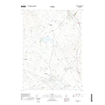
2018 Map of Farmington
USGS Topo · Published 2018About this map
The Cocheco River winds through the heart of Farmington, serving as a central geographic anchor for this Strafford County landscape. This modern survey illustrates the transition from the dense settlement at Farmington to the more dispersed communities of Middleton Corners and Union to the north. Water dominates the western and central terrain, where Sunrise Lake and Currier Pond are surrounded by a network of local roads such as Kings Hwy and New Durham Rd.
Find a feature on this map
117 named features on this map. Tap any name to fly to it.
Don’t see what you’re looking for? This feature index may not catch every label — zoom into the map to look around manually.
Map Details
Editions of this 2018 Farmington Map
This is the sole edition of this map. No revisions or reprints were ever made.
Other maps of this area

1891 · Berwick
USGS Topo · 1:62,500

1891 · Newfield
USGS Topo · 1:62,500

1893 · Berwick
USGS Topo · 1:62,500

1893 · Newfield
USGS Topo · 1:62,500

1919 · Alton
USGS Topo · 1:62,500

1928 · Wolfeboro
USGS Topo · 1:62,500

1933 · Berwick
USGS Topo · 1:48,000

1933 · Newfield
USGS Topo · 1:48,000

1937 · Newfield
USGS Topo · 1:62,500

1937 · Berwick
USGS Topo · 1:62,500