
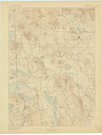
1893 Map of Newfield
USGS Topo · Published 1893About this map
Salmon Falls River and the New Hampshire Maine Boundary Line define the western edge of this 1889 survey, where the rolling hills of York County meet the granite state. The landscape is dotted with water-powered industrial sites like Ossipee Mills and Milton Mills, reflecting a late-19th-century economy deeply tied to the Little Ossipee River and the numerous glacial lakes that characterize the region.
Find a feature on this map
58 named features on this map. Tap any name to fly to it.
Don’t see what you’re looking for? This feature index may not catch every label — zoom into the map to look around manually.
Map Details
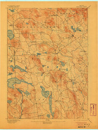
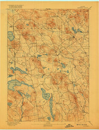
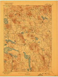
Editions of this 1893 Newfield Map
6 editions found

Other maps of this area

1891 · Berwick
USGS Topo · 1:62,500

1891 · Kennebunk
USGS Topo · 1:62,500

1891 · Buxton
USGS Topo · 1:62,500

1891 · Newfield
USGS Topo · 1:62,500

1892 · Buxton
USGS Topo · 1:62,500

1893 · Kennebunk
USGS Topo · 1:62,500

1893 · Berwick
USGS Topo · 1:62,500

1893 · Buxton
USGS Topo · 1:62,500

1896 · Sebago
USGS Topo · 1:62,500

1898 · Kennebunk
USGS Topo · 1:62,500