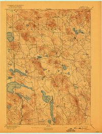
1893 Map of Newfield
USGS Topo · Published 1922About this map
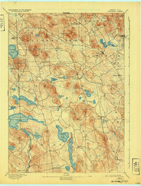
Great East Pond and the New Hampshire Maine Boundary Line define the western reaches of this late 19th-century survey. The landscape is dominated by a series of distinct peaks such as Randall Mountain and Hosac Mountain, which hem in a network of ponds and glacial water bodies. Settlements like Limerick, Newfield, and Parsonsfield appear as established rural hubs connected by a dense web of carriage roads before the arrival of modern highways.
Find a feature on this map
57 named features on this map. Tap any name to fly to it.
Don’t see what you’re looking for? This feature index may not catch every label — zoom into the map to look around manually.
Map Details
Editions of this 1893 Newfield Map
6 editions found
Other maps of this area

1891 · Berwick
USGS Topo · 1:62,500

1891 · Kennebunk
USGS Topo · 1:62,500

1891 · Buxton
USGS Topo · 1:62,500

1891 · Newfield
USGS Topo · 1:62,500

1892 · Buxton
USGS Topo · 1:62,500

1893 · Kennebunk
USGS Topo · 1:62,500

1893 · Berwick
USGS Topo · 1:62,500

1893 · Buxton
USGS Topo · 1:62,500

1893 · Newfield
USGS Topo · 1:62,500

1896 · Sebago
USGS Topo · 1:62,500