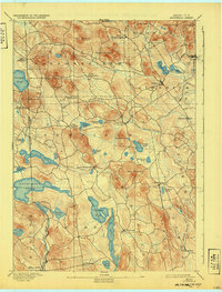
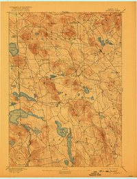
1893 Map of Newfield
USGS Topo · Published 1932About this map
The New Hampshire Maine boundary line defines the western edge of this 1889 survey, where the rugged topography of York County is punctuated by dozens of glacial ponds and small milling settlements. The Little Ossipee River winds through the central landscape, supporting industrial clusters at Newfield and Ossipee Mills. This era's local economy is clearly visible through the network of roads connecting crossroads such as North Shapleigh and Ross Corner to the larger centers of Limerick and Parsonsfield.
Find a feature on this map
57 named features on this map. Tap any name to fly to it.
Don’t see what you’re looking for? This feature index may not catch every label — zoom into the map to look around manually.
Map Details
Editions of this 1893 Newfield Map
6 editions found
Other maps of this area

1891 · Berwick
USGS Topo · 1:62,500

1891 · Kennebunk
USGS Topo · 1:62,500

1891 · Buxton
USGS Topo · 1:62,500

1891 · Newfield
USGS Topo · 1:62,500

1892 · Buxton
USGS Topo · 1:62,500

1893 · Kennebunk
USGS Topo · 1:62,500

1893 · Berwick
USGS Topo · 1:62,500

1893 · Buxton
USGS Topo · 1:62,500

1893 · Newfield
USGS Topo · 1:62,500

1896 · Sebago
USGS Topo · 1:62,500