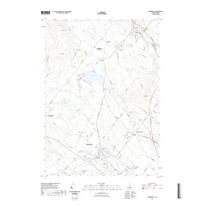
2021 Map of Farmington
USGS Topo · Published 2021About this map
Farmington serves as the primary hub of this landscape, situated at the convergence of the Cocheco River, Mad River, and the Ela River. The town's industrial heritage is hinted at by the presence of the Waldron Mill Pond, while its local history is preserved in several family-named burial grounds including Pine Grove Cem, Whitehouse Cem, and Nutes Ridge Cem. The area's character is defined by a series of north-south ridges, most notably Birch Ridge and Teneriffe Mtn, which separate the river valleys.
Find a feature on this map
117 named features on this map. Tap any name to fly to it.
Don’t see what you’re looking for? This feature index may not catch every label — zoom into the map to look around manually.
Map Details
Editions of this 2021 Farmington Map
This is the sole edition of this map. No revisions or reprints were ever made.
Other maps of this area

1891 · Berwick
USGS Topo · 1:62,500

1891 · Newfield
USGS Topo · 1:62,500

1893 · Berwick
USGS Topo · 1:62,500

1893 · Newfield
USGS Topo · 1:62,500

1919 · Alton
USGS Topo · 1:62,500

1928 · Wolfeboro
USGS Topo · 1:62,500

1933 · Berwick
USGS Topo · 1:48,000

1933 · Newfield
USGS Topo · 1:48,000

1937 · Newfield
USGS Topo · 1:62,500

1937 · Berwick
USGS Topo · 1:62,500