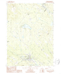
1987 Map of Farmington
USGS Topo · Published 1987About this map
The Cocheco River carves through this Strafford County landscape, serving as the historical backbone for the town of Farmington. By the late 20th century, the area shows a transition from traditional river-bound development to upland recreational and residential sites, particularly around Sunrise Lake and the various clusters at Middleton Corners and New Durham Corner. The terrain is defined by prominent elevations such as Birch Ridge and Nute Ridge, which constrain the movement of water through smaller tributaries like Mad River and Great Brook. Evidence of the region's industrial past is visible in the Old Railroad Grade and several Sandpits, while contemporary land use is marked by a Golf Course, Campground, and a Sewage Disposal Plant near the main settlement. Small cemeteries and local landmarks like Roadside Park offer specific points of interest for those tracing family history in this part of New Hampshire.
Find a feature on this map
40 named features on this map. Tap any name to fly to it.
Don’t see what you’re looking for? This feature index may not catch every label — zoom into the map to look around manually.
Map Details
Editions of this 1987 Farmington Map
This is the sole edition of this map. No revisions or reprints were ever made.
Other maps of this area

1891 · Berwick
USGS Topo · 1:62,500

1891 · Newfield
USGS Topo · 1:62,500

1893 · Berwick
USGS Topo · 1:62,500

1893 · Newfield
USGS Topo · 1:62,500

1919 · Alton
USGS Topo · 1:62,500

1928 · Wolfeboro
USGS Topo · 1:62,500

1933 · Berwick
USGS Topo · 1:48,000

1933 · Newfield
USGS Topo · 1:48,000

1937 · Newfield
USGS Topo · 1:62,500

1937 · Berwick
USGS Topo · 1:62,500