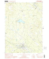
2000 Map of Farmington
USGS Topo · Published 2001About this map
Farmington and the surrounding township at the turn of the millennium center on the convergence of the Cocheco River and the Mad River. The landscape is defined by the prominent heights of Birch Ridge and Nute Ridge, which shelter numerous bodies of water including Sunrise Lake and Gould Pond. An Old Railroad Grade traces a legacy of transportation through the valley, passing near Hayes Corner and Farmington. This 2000-era survey documents the persistent rural character of the area, punctuated by small settlements like Union and Middleton Corners. Conservation efforts are visible through the Jones Brook State Wildlife Management Area and Milton Mills State Wildlife Management Area, preserving the watershed of Jones Brook and its tributaries near the Strafford and Carroll county line.
Find a feature on this map
41 named features on this map. Tap any name to fly to it.
Don’t see what you’re looking for? This feature index may not catch every label — zoom into the map to look around manually.
Map Details
Editions of this 2000 Farmington Map
This is the sole edition of this map. No revisions or reprints were ever made.
Other maps of this area

1891 · Berwick
USGS Topo · 1:62,500

1891 · Newfield
USGS Topo · 1:62,500

1893 · Berwick
USGS Topo · 1:62,500

1893 · Newfield
USGS Topo · 1:62,500

1919 · Alton
USGS Topo · 1:62,500

1928 · Wolfeboro
USGS Topo · 1:62,500

1933 · Berwick
USGS Topo · 1:48,000

1933 · Newfield
USGS Topo · 1:48,000

1937 · Newfield
USGS Topo · 1:62,500

1937 · Berwick
USGS Topo · 1:62,500