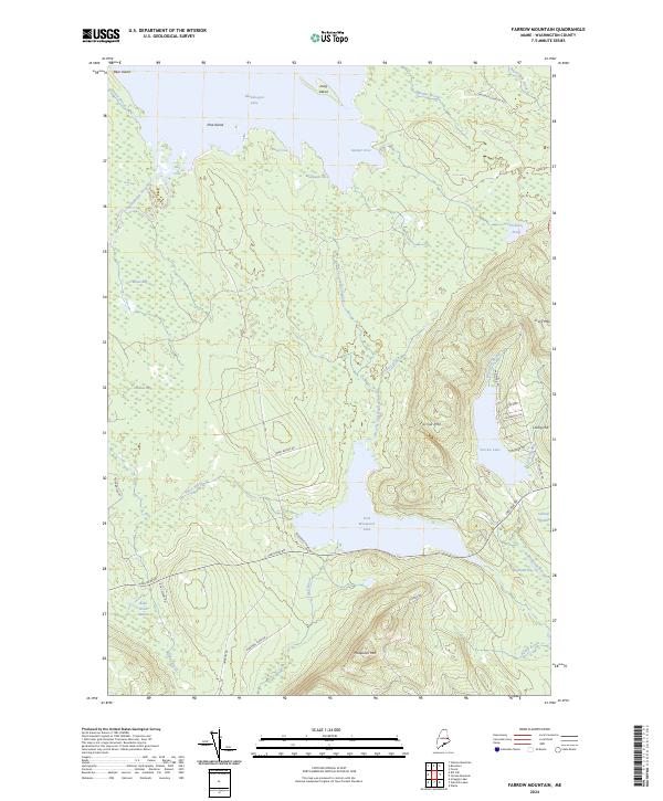
2024 Map of Farrow Mountain
USGS Topo · Published 2024About this map
Baskahegan Lake and the northern reach of East Musquash Lake dominate this portion of the Maine interior, where water and wetlands dictate the movement of both industry and travelers. The landscape is a network of complex hydrography, featuring the wide expanses of Farrow Lake and numerous tributary systems like Baskahegan Stream and Brooks and Walden Brook. High ground is concentrated in the east, anchored by the prominent elevations of Farrow Mtn and Musquash Mtn.
Find a feature on this map
48 named features on this map. Tap any name to fly to it.
Don’t see what you’re looking for? This feature index may not catch every label — zoom into the map to look around manually.
Map Details
Editions of this 2024 Farrow Mountain Map
This is the sole edition of this map. No revisions or reprints were ever made.
Other maps of this area
1940 · Danforth
USGS Topo · 1:62,500
1940 · Waite
USGS Topo · 1:62,500
1940 · Forest
USGS Topo · 1:62,500
1941 · Danforth
USGS Topo · 1:62,500
1941 · Scraggly Lake
USGS Topo · 1:62,500
1942 · Waite
USGS Topo · 1:62,500
1942 · Forest
USGS Topo · 1:62,500
1943 · Danforth
USGS Topo · 1:62,500
1944 · Scraggly Lake
USGS Topo · 1:62,500
1957 · Fredericton
USGS Topo · 1:250,000