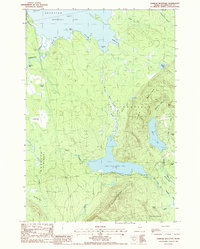
1988 Map of Farrow Mountain
USGS Topo · Published 1988About this map
Farrow Mountain and Musquash Mountain anchor this interior Maine landscape, where the waters of East Musquash Lake and Baskahegan Lake dominate the terrain. This late twentieth-century survey reveals a region defined by complex hydrology, from the churning Black Cat Rips on the Baskahegan Stream to the expansive wetlands of Crabtree Bog and Caribou Bog. The map delineates the township boundaries of Topsfield, Brookton, and Talmadge, illustrating how human administrative lines overlay a wilderness of granite peaks and glacial depressions.
Find a feature on this map
38 named features on this map. Tap any name to fly to it.
Don’t see what you’re looking for? This feature index may not catch every label — zoom into the map to look around manually.
Map Details
Editions of this 1988 Farrow Mountain Map
This is the sole edition of this map. No revisions or reprints were ever made.
Other maps of this area

1940 · Danforth
USGS Topo · 1:62,500

1940 · Waite
USGS Topo · 1:62,500

1940 · Forest
USGS Topo · 1:62,500

1941 · Danforth
USGS Topo · 1:62,500

1941 · Scraggly Lake
USGS Topo · 1:62,500

1942 · Waite
USGS Topo · 1:62,500

1942 · Forest
USGS Topo · 1:62,500

1943 · Danforth
USGS Topo · 1:62,500

1944 · Scraggly Lake
USGS Topo · 1:62,500

1957 · Fredericton
USGS Topo · 1:250,000