2023 Map of Fayetteville
USGS Topo · Published 2023About this map
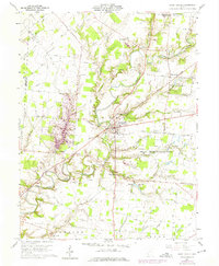
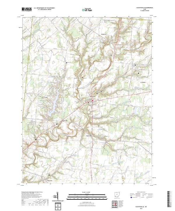
The East Fork Little Miami River winds through this section of Brown County, anchoring a landscape where historic Catholic institutions and rural settlements converge. At St. Martin, the campus of Chatfield College sits adjacent to the Ursuline Cem and Saint Martins Cem, marking a long-standing educational and religious presence in the area. Further west, the planned community surrounding Lake Lorelei contrasts with the traditional village layouts of Fayetteville and Chasetown. The map reveals a dense distribution of family and parish burial grounds, including the Engle Cem, Dunham Cem, and Vera Cruz Cem, which provide significant touchpoints for genealogical research. Water features like Winandi Reservoir and Lake Fichtelberg highlight more recent residential and recreational development among the older agricultural road networks of Ferristown and Vera Cruz.
Find a feature on this map
108 named features on this map. Tap any name to fly to it.
Don’t see what you’re looking for? This feature index may not catch every label — zoom into the map to look around manually.
Map Details
Editions of this 2023 Fayetteville Map
This is the sole edition of this map. No revisions or reprints were ever made.