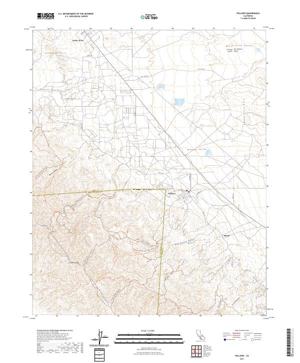
2021 Map of Fellows
USGS Topo · Published 2021About this map
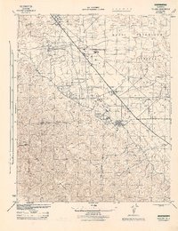
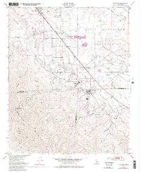
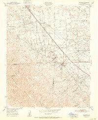
The Temblor Range defines the southwestern portion of this Kern County survey, rising above the oil-producing lands of the Central San Joaquin Valley. The settlement of Fellows sits at the intersection of Broadway and Midway Road, serving as a central hub in an area defined by its petroleum geography. Northward, Derby Acres occupies the transition between the Telephone Hills and the floor of the Midway Valley. The landscape is etched with industrial and transport infrastructure, including Mocal Road and Bill Kirby Road, which navigate the folds of the Buena Vista Hills. Local history is preserved in the names of natural landmarks like Dabney Canyon and Seventeen Canyon, alongside high points such as Midway Peak. The map provides a detailed view of the rugged boundary between San Luis Obispo and Kern counties, tracing trails like the Temblor Ridge Trail.
Find a feature on this map
40 named features on this map. Tap any name to fly to it.
Don’t see what you’re looking for? This feature index may not catch every label — zoom into the map to look around manually.
Map Details
Editions of this 2021 Fellows Map
This is the sole edition of this map. No revisions or reprints were ever made.
Historical Maps of Derby Acres Through Time
4 maps found