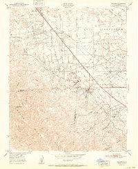
1951 Map of Fellows
USGS Topo · Published 1951About this map
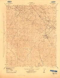
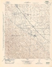
Naval Petroleum Reserve No 2 dominates the high desert terrain of the Buena Vista Hills in this early 1950s survey. The landscape is defined by the extraction infrastructure of the era, with dense concentrations of Oil Wells and a network of pipelines serving the Midway Pumping Sta. The community of Fellows serves as the central hub, supported by the Midway School and company-specific residential outposts like Associated Oil Camp and Midway Oil Camp. To the west, the rugged elevations of the Temblor Range rise sharply, cut by steep drainages such as McLeod Canyon and Hale Canyon. This map documents a period when the local economy was inextricably tied to the federal petroleum reserves and the strategic energy needs of the post-war United States.
Find a feature on this map
24 named features on this map. Tap any name to fly to it.
Don’t see what you’re looking for? This feature index may not catch every label — zoom into the map to look around manually.
Map Details
Editions of this 1951 Fellows Map
This is the sole edition of this map. No revisions or reprints were ever made.
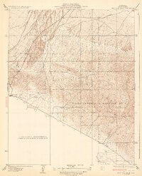
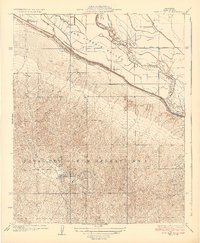
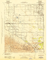
Other maps of this area

1910 · Buena Vista Lake
USGS Topo · 1:125,000

1912 · McKittrick
USGS Topo · 1:125,000

1912 · Buena Vista Lake
USGS Topo · 1:125,000
1932 · West Elk Hills
USGS Topo · 1:31,680
1932 · East Elk Hills
USGS Topo · 1:31,680
1942 · Buttonwillow
USGS Topo · 1:62,500
1943 · Maricopa
USGS Topo · 1:31,680

1944 · Panorama Hills
USGS Topo · 1:31,680
1944 · Fellows
USGS Topo · 1:31,680

1944 · Elkhorn Hills
USGS Topo · 1:31,680