
1912 Map of McKittrick
USGS Topo · Published 1912About this map
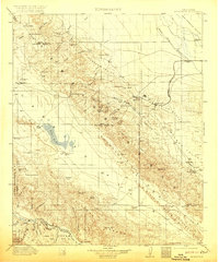
The rugged Temblor Range and the arid basins of the southern San Joaquin Valley dominate this 1912 survey, capturing the region during the early development of its oil and ranching economies. The infrastructure of the Pacific Southern railroad connects the nascent town of McKittrick to the remote valley outposts, while the surrounding landscape is dotted with early 20th-century family holdings like McAlesters Ranch and Joe Santos Ranch. To the west, the white expanse of Soda Lake sits in the Carrizo Plain, bordered by unique landmarks such as Painted Rock. The map reflects a hardscrabble frontier era where water sources like Carneros Spring and Sheep Springs were vital for the survival of both livestock and workers in the Midway Valley. Evidence of early community life is seen at the Buttonwillow School and the isolated Midland PO.
Find a feature on this map
74 named features on this map. Tap any name to fly to it.
Don’t see what you’re looking for? This feature index may not catch every label — zoom into the map to look around manually.
Map Details
Editions of this 1912 McKittrick Map
4 editions found
Other maps of this area

1902 · Santa Ynez
USGS Topo · 1:125,000

1903 · Mt. Pinos
USGS Topo · 1:125,000

1905 · Santa Ynez
USGS Topo · 1:125,000

1905 · Lompoc
USGS Topo · 1:125,000

1910 · Buena Vista Lake
USGS Topo · 1:125,000

1912 · Buena Vista Lake
USGS Topo · 1:125,000

1914 · Lost Hills
USGS Topo · 1:125,000

1914 · Cholame
USGS Topo · 1:125,000

1915 · Cholame
USGS Topo · 1:125,000

1917 · Cholame
USGS Topo · 1:125,000