
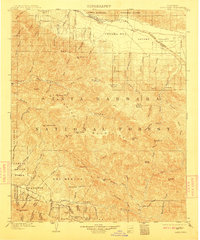
1905 Map of Santa Ynez
USGS Topo · Published 1905About this map
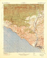
Santa Barbara Forest Reserve dominates this 1905 landscape, a vast expanse of the San Rafael Mountains before the modern reconfiguration of National Forest boundaries. The map captures a rugged transition between the Cuyama Valley in the north and the coastal foothills near San Marcos. Of significant interest to local historians are the established "potreros" or mountain meadows, such as Montgomery Potrero and Salisbury Potrero, which denote early livestock grazing patterns in the high country. Near the southern edge, the map documents the historical crossing at San Marcos Pass and the culturally significant Painted Cave. The small settlement of Wasioja stands as a lonely outpost in the north, while the interior is defined by complex drainage systems like Mono Creek and Indian Creek that feed the Santa Ynez River.
Find a feature on this map
84 named features on this map. Tap any name to fly to it.
Don’t see what you’re looking for? This feature index may not catch every label — zoom into the map to look around manually.
Map Details
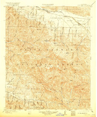
Editions of this 1905 Santa Ynez Map
5 editions found
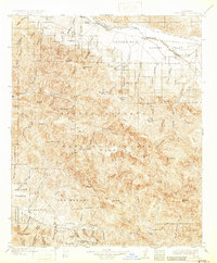
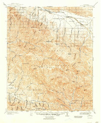
Other maps of this area

1902 · Santa Ynez
USGS Topo · 1:125,000

1903 · Mt. Pinos
USGS Topo · 1:125,000

1904 · Ventura
USGS Topo · 1:62,500

1905 · Lompoc
USGS Topo · 1:125,000

1910 · Buena Vista Lake
USGS Topo · 1:125,000

1912 · McKittrick
USGS Topo · 1:125,000

1912 · Buena Vista Lake
USGS Topo · 1:125,000

1937 · Branch Mtn
USGS Topo · 1:48,000
1941 · Ventura
USGS Topo · 1:62,500
1941 · San Rafael Mtn.
USGS Topo · 1:62,500