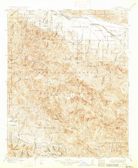
1905 Map of Santa Ynez
USGS Topo · Published 1932About this map
The San Rafael Mountains dominate this 1905 survey, illustrating a remote landscape of the early twentieth century defined by massive cattle ranches and rugged topography. The Cuyama Valley in the north serves as a key agricultural corridor, dotted with the Cuyama Ranch and Wasioja settlement. Large land grants and boundaries like San Marcos and Canada de los Pinos reflect the region's ranching heritage.
Find a feature on this map
50 named features on this map. Tap any name to fly to it.
Don’t see what you’re looking for? This feature index may not catch every label — zoom into the map to look around manually.
Map Details
Editions of this 1905 Santa Ynez Map
5 editions found
Other maps of this area

1902 · Santa Ynez
USGS Topo · 1:125,000

1903 · Mt. Pinos
USGS Topo · 1:125,000

1904 · Ventura
USGS Topo · 1:62,500

1905 · Santa Ynez
USGS Topo · 1:125,000

1905 · Lompoc
USGS Topo · 1:125,000

1910 · Buena Vista Lake
USGS Topo · 1:125,000

1912 · McKittrick
USGS Topo · 1:125,000

1912 · Buena Vista Lake
USGS Topo · 1:125,000

1937 · Branch Mtn
USGS Topo · 1:48,000

1941 · Ventura
USGS Topo · 1:62,500