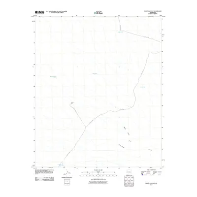
2010 Map of Fence Canyon
USGS Topo · Published 2010About this map
Graham Ranch serves as a lone human landmark in this arid stretch of Sierra County, marking a site of habitation and cattle ranching in the high desert. The landscape is defined by the drainage patterns of Fence Canyon and Middle Canyon, which cut through the limestone and gypsum deposits of the Gyp Hills. Water management is the primary logistical concern of this era, as evidenced by a network of named catchment basins including Bull Pasture Tank, Army Tank, and Fuller Tank. These features are connected by a series of graded routes such as County Rd-A029 and County Rd-A030, reflecting the continued importance of ranching infrastructure and land access in the early 21st century.
Find a feature on this map
13 named features on this map. Tap any name to fly to it.
Don’t see what you’re looking for? This feature index may not catch every label — zoom into the map to look around manually.
Map Details
Editions of this 2010 Fence Canyon Map
This is the sole edition of this map. No revisions or reprints were ever made.
Other maps of this area

1916 · Salinas Peak
USGS Topo · 1:125,000

1948 · Sowell
USGS Topo · 1:62,500

1948 · Malpais Well
USGS Topo · 1:62,500

1948 · Black Top Mountain
USGS Topo · 1:62,500

1948 · Salinas Peak
USGS Topo · 1:62,500

1954 · Tularosa
USGS Topo · 1:250,000

1958 · Tularosa
USGS Topo · 1:250,000

1981 · Big Gyp Mountain
USGS Topo · 1:24,000
1981 · Shannon Canyon
USGS Topo · 1:24,000
1981 · Hardscrabble Mountains
USGS Topo · 1:24,000