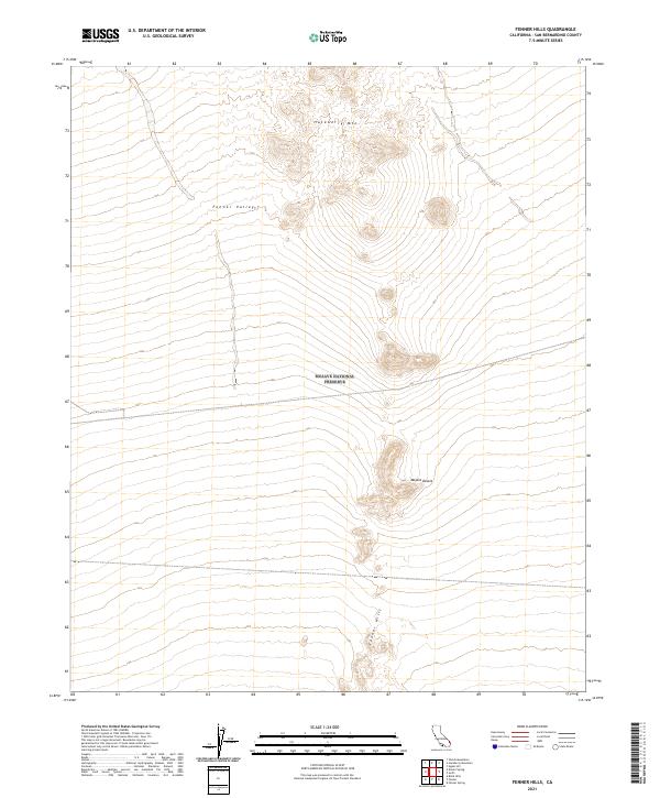
2021 Map of Fenner Hills
USGS Topo · Published 2021About this map
Mojave National Preserve encompasses much of this arid landscape, where the high desert terrain transitions from the volcanic heights of Hackberry Mtn down into the expansive Fenner Valley. This 2021 survey illustrates the characteristic drainage patterns of the Mojave Desert, showing how seasonal runoff from the Fenner Hills shapes the topography of the basin. The map provides a precise look at the township and range system, including t11n r17e and t10n r17e, delineating the spatial organization of this protected wilderness area. For those studying the environmental history of San Bernardino County, the map details the subtle elevation changes and landforms that define this corner of the national preserve.
Find a feature on this map
11 named features on this map. Tap any name to fly to it.
Don’t see what you’re looking for? This feature index may not catch every label — zoom into the map to look around manually.
Map Details
Editions of this 2021 Fenner Hills Map
This is the sole edition of this map. No revisions or reprints were ever made.
Other maps of this area

1910 · Ivanpah
USGS Topo · 1:250,000

1912 · Ivanpah
USGS Topo · 1:250,000

1942 · Ivanpah
USGS Topo · 1:250,000

1942 · Amboy
USGS Topo · 1:250,000

1943 · Amboy
USGS Topo · 1:250,000

1943 · Fenner
USGS Topo · 1:62,500

1947 · Kingman
USGS Topo · 1:250,000

1948 · Kingman
USGS Topo · 1:250,000

1954 · Needles
USGS Topo · 1:250,000

1954 · Kingman
USGS Topo · 1:250,000