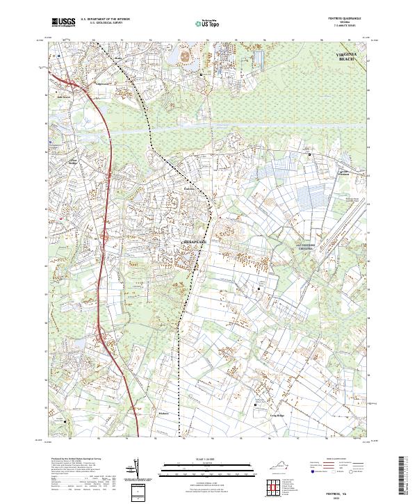
2022 Map of Fentress
USGS Topo · Published 2022About this map
The Intracoastal Waterway cuts through this landscape where the independent cities of Virginia Beach and Chesapeake meet. Centered on the community of Fentress, the map reveals a transition from the dense residential developments of Great Bridge and Oak Grove in the northwest to the agricultural and wetland expanses of the south and east. Significant historical sites are documented here, including the Cuffeytown Historic Cem and the isolated Lindsay Sivills Grave. The maritime and military character of the region is evident in the presence of the Southern Branch Elizabeth River and the Fentress Naval Auxiliary Field, while the southern reaches remain defined by rural corridors along Land of Promise Rd and the edges of Gum Swamp. This survey provides a precise look at the suburban expansion and preserved rural pockets of the Hampton Roads area.
Find a feature on this map
39 named features on this map. Tap any name to fly to it.
Don’t see what you’re looking for? This feature index may not catch every label — zoom into the map to look around manually.
Map Details
Editions of this 2022 Fentress Map
This is the sole edition of this map. No revisions or reprints were ever made.
Other maps of this area

1907 · Norfolk
USGS Topo · 1:125,000

1918 · Cape Henry
USGS Topo · 1:62,500

1919 · Cape Henry
USGS Topo · 1:62,500

1921 · Newport News
USGS Topo · 1:62,500

1939 · Moyock
USGS Topo · 1:62,500

1940 · Lake Drummond
USGS Topo · 1:62,500

1944 · Norfolk South
USGS Topo · 1:25,000

1945 · Lake Drummond
USGS Topo · 1:62,500

1946 · Moyock
USGS Topo · 1:62,500

1948 · Norfolk South
USGS Topo · 1:24,000