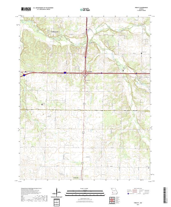
2021 Map of Fidelity
USGS Topo · Published 2021About this map
Fidelity and Diamond anchor this 2021 survey of the borderlands between Jasper and Newton Counties. The landscape is defined by the branching tributaries of Center Creek, including Jones Creek and Jenkins Creek, which carve through the terrain south of Carthage. This rural expanse is notable for its high density of local burial sites, providing significant value for genealogical research. Documented landmarks include Fullerton Cem, Moss Springs Cem, and the centrally located Fidelity Cem. The map illustrates the contemporary road network, showing how modern routes like Cimmarron Rd and Newton Rd intersect with traditional farm-to-market pathways. The transition from the outskirts of Carthage in the north to the more open agricultural reaches near Diamond reflects the enduring rural character of this Southwest Missouri region.
Find a feature on this map
79 named features on this map. Tap any name to fly to it.
Don’t see what you’re looking for? This feature index may not catch every label — zoom into the map to look around manually.
Map Details
Editions of this 2021 Fidelity Map
This is the sole edition of this map. No revisions or reprints were ever made.
Other maps of this area

1886 · Carthage
USGS Topo · 1:125,000

1894 · Carthage
USGS Topo · 1:125,000

1916 · Neosho
USGS Topo · 1:62,500

1921 · Sarcoxie
USGS Topo · 1:62,500

1943 · Ritchey
USGS Topo · 1:62,500

1947 · Joplin
USGS Topo · 1:250,000

1949 · Joplin
USGS Topo · 1:250,000

1954 · Tulsa
USGS Topo · 1:250,000

1954 · Joplin
USGS Topo · 1:250,000

1958 · Joplin
USGS Topo · 1:250,000