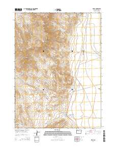
2014 Map of Fields
USGS Topo · Published 2014About this map
The settlement of Fields anchors the southern portion of this high-desert landscape in Harney County, serving as a vital point of transit where Fields Denio Rd and Catlow Valley Rd converge. This area is defined by dramatic elevation changes, notably the towering presence of Steens Mtn and its prominent peaks like Alvord Peak and Red Mtn.
Find a feature on this map
31 named features on this map. Tap any name to fly to it.
Don’t see what you’re looking for? This feature index may not catch every label — zoom into the map to look around manually.
Map Details
Editions of this 2014 Fields Map
This is the sole edition of this map. No revisions or reprints were ever made.
Other maps of this area

1955 · Adel
USGS Topo · 1:250,000

1957 · Adel
USGS Topo · 1:250,000

1958 · Adel
USGS Topo · 1:250,000

1962 · Adel
USGS Topo · 1:250,000

1971 · Fields Basin
USGS Topo · 1:24,000

1971 · Andrews
USGS Topo · 1:24,000

1971 · V Lake
USGS Topo · 1:24,000

1971 · Fields
USGS Topo · 1:24,000

1971 · Borax Lake
USGS Topo · 1:24,000
1971 · Skull Creek Butte
USGS Topo · 1:24,000