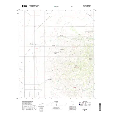
2018 Map of Fife Peak
USGS Topo · Published 2018About this map
The Chiricahua Mountains dominate this high-elevation landscape within the Coronado National Forest, where a network of drainage systems and watering points defines the arid environment. Prominent peaks like Fife Peak rise above a complex series of deep-cut drainages, including Fife Canyon, Trunk Canyon, and the distinct trio of North Witch Canyon, Middle Witch Canyon, and South Witch Canyon. Water management is the primary sign of human activity in this terrain, evidenced by numerous named stock tanks and natural water sources such as Bumblebee Tank, Concrete Tank, Madrona Spring, and Ratliff Spring. These features suggest a landscape utilized for livestock grazing and resource management. Transportation is limited to narrow routes like Rock Creek Rd and Sunrise Dr, reflecting the area's protected status and limited development at the edge of the range.
Find a feature on this map
41 named features on this map. Tap any name to fly to it.
Don’t see what you’re looking for? This feature index may not catch every label — zoom into the map to look around manually.
Map Details
Editions of this 2018 Fife Peak Map
This is the sole edition of this map. No revisions or reprints were ever made.
Other maps of this area

1916 · Pearce
USGS Topo · 1:125,000

1917 · San Simon
USGS Topo · 1:125,000

1917 · Chiricahua
USGS Topo · 1:125,000

1919 · Chiricahua
USGS Topo · 1:125,000

1922 · Willcox
USGS Topo · 1:125,000

1926 · Light
USGS Topo · 1:62,500

1926 · Cochise Head
USGS Topo · 1:62,500

1926 · Rucker
USGS Topo · 1:62,500

1943 · Dos Cabezas
USGS Topo · 1:62,500

1950 · Cochise Head
USGS Topo · 1:62,500