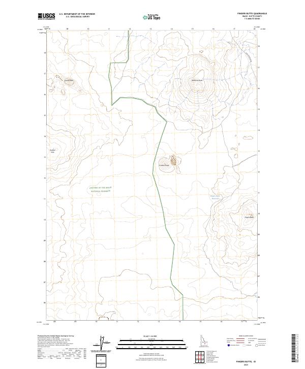
2023 Map of Fingers Butte
USGS Topo · Published 2023About this map
Volcanic landforms and high desert plains define the landscape within the Craters of the Moon National Preserve, where distinctive elevations rise sharply from the surrounding flats. The survey area is marked by several prominent topographic features, including Wildhorse Butte, Cruthers Butte, and the namesake Fingers Butte. These formations suggest the complex geological history of this corner of Butte County, where water is a scarce and managed resource as evidenced by the remote Fingers Butte Reservoir and the uniquely named Huddles Hole. The Arco-Minidoka Rd provides the primary transit route through this section of the preserve, following the natural contours of the basin. This map serves as a detailed record of public land boundaries, specifically identifying townships t2n r26e, t2n r27e, t1n r26e, and t1n r27e, which are essential for understanding local land management and historical surveying lines.
Find a feature on this map
12 named features on this map. Tap any name to fly to it.
Don’t see what you’re looking for? This feature index may not catch every label — zoom into the map to look around manually.
Map Details
Editions of this 2023 Fingers Butte Map
This is the sole edition of this map. No revisions or reprints were ever made.
Other maps of this area

1955 · Idaho Falls
USGS Topo · 1:250,000

1958 · Idaho Falls
USGS Topo · 1:250,000

1972 · Quaking Aspen Butte
USGS Topo · 1:24,000

1972 · Pratt Butte
USGS Topo · 1:24,000

1972 · Arco South
USGS Topo · 1:24,000

1972 · Butte City
USGS Topo · 1:24,000

1972 · Nichols Reservoir
USGS Topo · 1:24,000

1972 · Fingers Butte
USGS Topo · 1:24,000

1972 · Serviceberry Butte
USGS Topo · 1:24,000
1973 · Fissure Butte
USGS Topo · 1:24,000