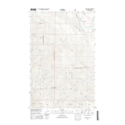
2014 Map of Finney Peak
USGS Topo · Published 2014About this map
Sauk sits near the confluence of the Skagit River and Miller Cr in this high-altitude survey of the Cascades. Much of the territory is defined by the Mount Baker National Forest, which covers the steep ridges and deep drainages of the N Fork Stillaguamish River and its various branches. The map provides a detailed look at the complex hydrological network of the region, including smaller tributaries like Nervous Bride Cr and Clemenson Cr. Significant vertical relief is marked by landmarks such as Sutter Mtn, Leonards Ridge, and the namesake Finney Peak. Modern road access is concentrated in the northeast corner near the river, where Concrete Sauk Valley Rd and several family-named lanes, including Kinley Ln and Hornbeck Ln, provide transit through the valley floor before the terrain ascends into protected forest lands.
Find a feature on this map
34 named features on this map. Tap any name to fly to it.
Don’t see what you’re looking for? This feature index may not catch every label — zoom into the map to look around manually.
Map Details
Editions of this 2014 Finney Peak Map
This is the sole edition of this map. No revisions or reprints were ever made.
Other maps of this area

1899 · Stillaguamish
USGS Topo · 1:125,000

1901 · Stilaguamish
USGS Topo · 1:125,000

1909 · Mt Baker
USGS Topo · 1:192,000

1915 · Mt. Baker
USGS Topo · 1:250,000

1952 · Lake Shannon
USGS Topo · 1:62,500

1952 · Hamilton
USGS Topo · 1:62,500

1955 · Concrete
USGS Topo · 1:250,000

1956 · Oso
USGS Topo · 1:62,500

1958 · Concrete
USGS Topo · 1:250,000

1962 · Concrete
USGS Topo · 1:250,000