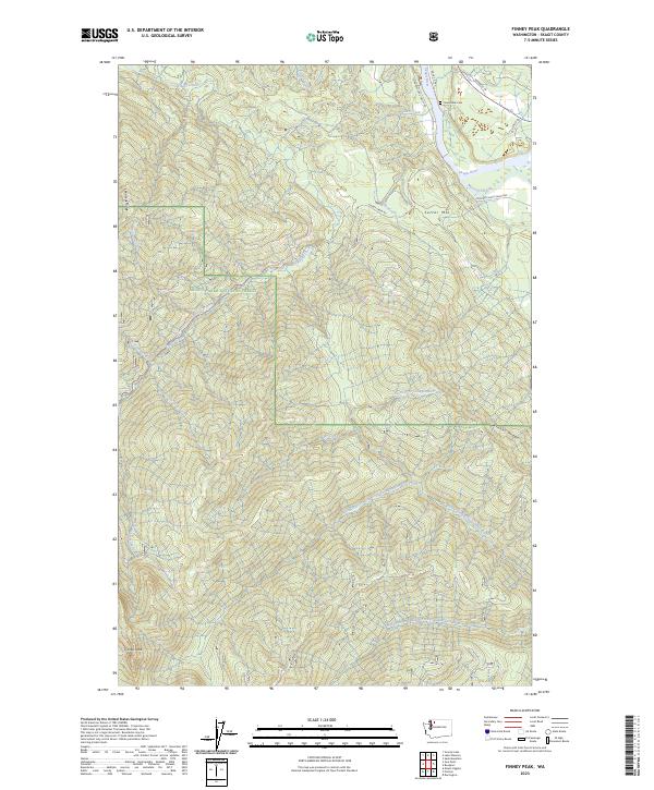
2023 Map of Finney Peak
USGS Topo · Published 2023About this map
Mount Baker National Forest dominates this landscape in the northern Cascades, where the terrain rises from the river lowlands to the high point at Finney Peak. The northeastern corner of the map centers on the Skagit Wild and Scenic River, a critical corridor where McLeod Slough and the Skagit River itself create a complex network of waterways. Along the Concrete Sauk Valley Rd, the presence of the Jones Sauk Cem provides a specific point of interest for genealogists and local historians, marking the human footprint in an otherwise wilderness-heavy quadrangle. To the south, the drainage patterns shift toward the North Fork Stillaguamish River, defined by deep valleys and prominent landforms such as Sutter Mtn, Leonards Ridge, and Rinker Ridge. The map illustrates a landscape of significant elevation changes and numerous tributaries including Nervous Bride Creek and Finney Creek.
Find a feature on this map
31 named features on this map. Tap any name to fly to it.
Don’t see what you’re looking for? This feature index may not catch every label — zoom into the map to look around manually.
Map Details
Editions of this 2023 Finney Peak Map
This is the sole edition of this map. No revisions or reprints were ever made.
Other maps of this area

1899 · Stillaguamish
USGS Topo · 1:125,000

1901 · Stilaguamish
USGS Topo · 1:125,000

1909 · Mt Baker
USGS Topo · 1:192,000

1915 · Mt. Baker
USGS Topo · 1:250,000

1952 · Lake Shannon
USGS Topo · 1:62,500

1952 · Hamilton
USGS Topo · 1:62,500

1955 · Concrete
USGS Topo · 1:250,000

1956 · Oso
USGS Topo · 1:62,500

1958 · Concrete
USGS Topo · 1:250,000

1962 · Concrete
USGS Topo · 1:250,000