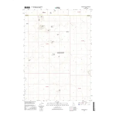
2017 Map of Fissure Butte
USGS Topo · Published 2017About this map
Craters of the Moon National Monument dominates this portion of the Snake River Plain, where the volcanic history of Blaine and Butte counties is written in recent lava flows and distinct cinder cones. The landscape is defined by the Great Rift, a massive fracture in the earth's crust that facilitated the emergence of the Sawtooth Flow and the Sentinel South Flow. The topographic detail illustrates a complex system of volcanic vents and formations, including the prominent Split Butte and Fissure Butte in the northern reach. Several distinct basaltic features like the Little Prairie Aa Flow and the Vermilion Chasm Flow highlight the varied textures of the cooling lava. For researchers, the map provides precise locations for remote geological landmarks such as Two Point Butte, Purple Butte, and the deep aperture of Vermilion Chasm.
Find a feature on this map
22 named features on this map. Tap any name to fly to it.
Don’t see what you’re looking for? This feature index may not catch every label — zoom into the map to look around manually.
Map Details
Editions of this 2017 Fissure Butte Map
This is the sole edition of this map. No revisions or reprints were ever made.
Other maps of this area

1955 · Idaho Falls
USGS Topo · 1:250,000

1958 · Idaho Falls
USGS Topo · 1:250,000

1972 · North Laidlaw Butte
USGS Topo · 1:24,000

1972 · Pratt Butte
USGS Topo · 1:24,000

1972 · Bear Den Butte
USGS Topo · 1:24,000

1972 · Bear Park East
USGS Topo · 1:24,000

1972 · Bear Park West
USGS Topo · 1:24,000

1972 · Fingers Butte
USGS Topo · 1:24,000

1972 · Inferno Cone
USGS Topo · 1:24,000
1973 · Fissure Butte
USGS Topo · 1:24,000