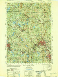
1953 Map of Fitchburg
USGS Topo · Published 1953About this map
Industrial centers and small mill towns define this early 1950s landscape along the Boston and Maine railroad corridor. The city of Fitchburg serves as the dominant urban hub, surrounded by a network of smaller communities like Blackburne Village and Waites Corner. The mapping captures the post-war transition of the region, where manufacturing footprints and transportation routes intersect with extensive conservation lands such as Marshall State Res and the Wachusett Mountain State Res.
Find a feature on this map
153 named features on this map. Tap any name to fly to it.
Don’t see what you’re looking for? This feature index may not catch every label — zoom into the map to look around manually.
Map Details
Editions of this 1953 Fitchburg Map
This is the sole edition of this map. No revisions or reprints were ever made.
Other maps of this area

1885 · Worcester
USGS Topo · 1:62,500

1886 · Worcester
USGS Topo · 1:62,500

1887 · Winchendon
USGS Topo · 1:62,500

1887 · Marlboro
USGS Topo · 1:62,500

1887 · Barre
USGS Topo · 1:62,500

1887 · Fitchburg
USGS Topo · 1:62,500

1889 · Marlboro
USGS Topo · 1:62,500

1889 · Fitchburg
USGS Topo · 1:62,500

1889 · Barre
USGS Topo · 1:62,500

1890 · Winchendon
USGS Topo · 1:62,500