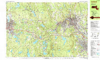
1988 Map of Fitchburg
USGS Topo · Published 1988About this map
The industrial corridor of northern Worcester County is captured in detail during the late 1980s, centered on the urban core of Fitchburg and its surrounding manufacturing towns. The Boston and Maine Railroad serves as a critical artery, threading through the landscape to connect Gardner and Leominster. This period reflects a transition from traditional industrial roots toward regional education and services, anchored by institutions like Fitchburg State College and Mount Wachusett Community College.
Find a feature on this map
131 named features on this map. Tap any name to fly to it.
Don’t see what you’re looking for? This feature index may not catch every label — zoom into the map to look around manually.
Map Details
Editions of this 1988 Fitchburg Map
This is the sole edition of this map. No revisions or reprints were ever made.
Other maps of this area

1885 · Worcester
USGS Topo · 1:62,500

1886 · Worcester
USGS Topo · 1:62,500

1887 · Winchendon
USGS Topo · 1:62,500

1887 · Marlboro
USGS Topo · 1:62,500

1887 · Barre
USGS Topo · 1:62,500

1887 · Fitchburg
USGS Topo · 1:62,500

1889 · Marlboro
USGS Topo · 1:62,500

1889 · Fitchburg
USGS Topo · 1:62,500

1889 · Barre
USGS Topo · 1:62,500

1890 · Winchendon
USGS Topo · 1:62,500