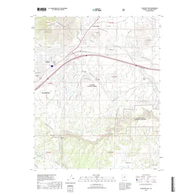
2018 Map of Flagstaff East
USGS Topo · Published 2018About this map
Elden Pueblo and the archaeological heritage of the Colorado Plateau define the northeastern edge of Flagstaff, where the terrain rises toward Elden Mtn. This 2018 survey documents the city's modern expansion around East Flagstaff and McMillan Mesa, while preserving the recreational and ecological significance of the Coconino National Forest. To the southeast, the dramatic topography of Walnut Canyon National Monument is clearly delineated, alongside geological features like the Bottomless Pit and Fisher Point. The map provides a detailed view of the regional water network, including Rio de Flag and Lake Mary Valley, while tracing modern infrastructure like College America Flagstaff and the extensive Arizona National Scenic Trail as it winds through the mesas and canyons.
Find a feature on this map
85 named features on this map. Tap any name to fly to it.
Don’t see what you’re looking for? This feature index may not catch every label — zoom into the map to look around manually.
Map Details
Editions of this 2018 Flagstaff East Map
This is the sole edition of this map. No revisions or reprints were ever made.
Other maps of this area

1886 · San Francisco Mtns
USGS Topo · 1:250,000

1891 · San Francisco Mtns
USGS Topo · 1:250,000

1894 · San Francisco Mtns
USGS Topo · 1:250,000

1899 · San Francisco Mtns
USGS Topo · 1:250,000

1908 · Flagstaff
USGS Topo · 1:125,000

1912 · Flagstaff
USGS Topo · 1:125,000

1947 · Flagstaff
USGS Topo · 1:250,000

1954 · Flagstaff
USGS Topo · 1:250,000

1958 · Flagstaff
USGS Topo · 1:250,000

1960 · Flagstaff
USGS Topo · 1:250,000