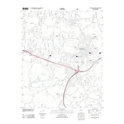
2011 Map of Flagstaff West
USGS Topo · Published 2011About this map
Lowell Observatory and Northern Arizona University anchor the cultural and intellectual landscape of western Flagstaff in this 2011 survey. The terrain is defined by high volcanic mesas and canyons, including Observatory Mesa, McMillan Mesa, and Switzer Canyon. Water management is prominent throughout the arid landscape, marked by numerous storage sites like Flagstaff City Reservoirs, A One Lake, and various stock tanks such as Matson Tank and Fuller Tank.
Find a feature on this map
86 named features on this map. Tap any name to fly to it.
Don’t see what you’re looking for? This feature index may not catch every label — zoom into the map to look around manually.
Map Details
Editions of this 2011 Flagstaff West Map
This is the sole edition of this map. No revisions or reprints were ever made.
Other maps of this area

1886 · San Francisco Mtns
USGS Topo · 1:250,000

1891 · San Francisco Mtns
USGS Topo · 1:250,000

1894 · San Francisco Mtns
USGS Topo · 1:250,000

1899 · San Francisco Mtns
USGS Topo · 1:250,000

1908 · Flagstaff
USGS Topo · 1:125,000

1912 · Flagstaff
USGS Topo · 1:125,000

1947 · Flagstaff
USGS Topo · 1:250,000

1954 · Flagstaff
USGS Topo · 1:250,000

1958 · Flagstaff
USGS Topo · 1:250,000

1960 · Flagstaff
USGS Topo · 1:250,000