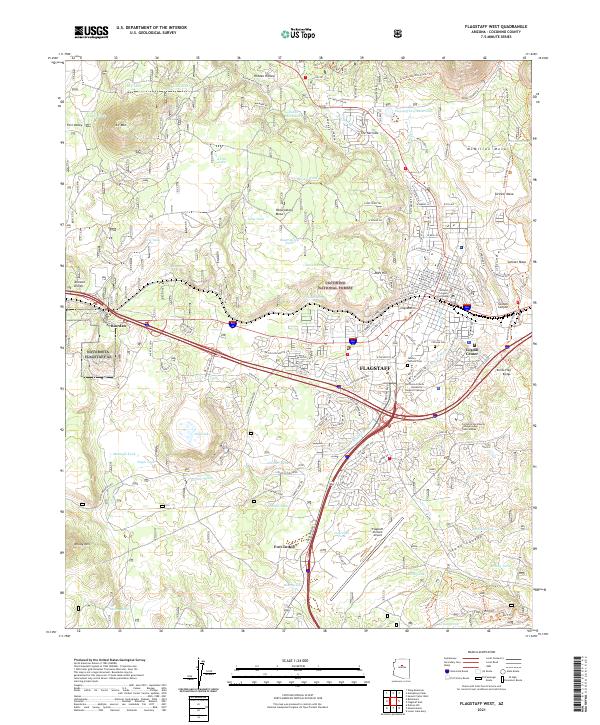
2021 Map of Flagstaff West
USGS Topo · Published 2021About this map
Coconino National Forest envelopes the western half of the city, providing a backdrop of high-altitude terrain dominated by Woody Mtn and A 1 Mtn. The urban landscape is anchored by the historic Coconino County Courthouse and the sprawling Northern Arizona University-Flagstaff Campus, which transitions into the city's eastern residential areas like McMillan Mesa and Switzer Mesa. The transit-oriented nature of the high desert is evident in the path of the BNSF Railway through Riordan and the heavy concentration of infrastructure near Flagstaff Pulliam Airport.
Find a feature on this map
143 named features on this map. Tap any name to fly to it.
Don’t see what you’re looking for? This feature index may not catch every label — zoom into the map to look around manually.
Map Details
Editions of this 2021 Flagstaff West Map
This is the sole edition of this map. No revisions or reprints were ever made.
Other maps of this area

1886 · San Francisco Mtns
USGS Topo · 1:250,000

1891 · San Francisco Mtns
USGS Topo · 1:250,000

1894 · San Francisco Mtns
USGS Topo · 1:250,000

1899 · San Francisco Mtns
USGS Topo · 1:250,000

1908 · Flagstaff
USGS Topo · 1:125,000

1912 · Flagstaff
USGS Topo · 1:125,000

1947 · Flagstaff
USGS Topo · 1:250,000

1954 · Flagstaff
USGS Topo · 1:250,000

1958 · Flagstaff
USGS Topo · 1:250,000

1960 · Flagstaff
USGS Topo · 1:250,000