2024 Map of Flat Rock
USGS Topo · Published 2024About this map
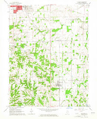
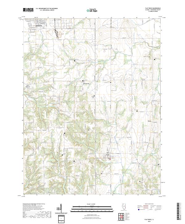
Flat Rock stands as the central hub of this agricultural landscape in southern Crawford County, defined by a dense network of family cemeteries and small rural settlements. The terrain is marked by the winding courses of Sugar Creek, Brushy Creek, and Lamotte Creek, which carve through the farmland between Duncanville and Morea. To the northwest, the southern outskirts of Robinson appear, featuring streets like E Saint Petersburg St and E Clearwater St. The map is particularly notable for genealogists, as it preserves the locations of numerous historic burial grounds including Good Hope Cem, Cecedar Cem, and the Seaney Cem. In the southern reaches, Campbell Lake and the Dickinson Cem provide landmarks for those tracing the history of the families who settled this region near New Hebron.
Find a feature on this map
62 named features on this map. Tap any name to fly to it.
Don’t see what you’re looking for? This feature index may not catch every label — zoom into the map to look around manually.
Map Details
Editions of this 2024 Flat Rock Map
This is the sole edition of this map. No revisions or reprints were ever made.