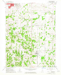
1964 Map of Flat Rock
USGS Topo · Published 1965About this map
Flat Rock and the surrounding Crawford County townships of La Motte, Honey Creek, and Montgomery define this 1964 landscape, where the local economy transition from agriculture to energy is clearly visible. The New York Central railroad cuts a diagonal line through the terrain, passing through Duncanville and skirting the edge of Robinson. Evidence of heavy industry and natural resource extraction appears in the form of numerous Oil Wells, a southern Strip Mine, and Coke Ovens near the city limits.
Find a feature on this map
40 named features on this map. Tap any name to fly to it.
Don’t see what you’re looking for? This feature index may not catch every label — zoom into the map to look around manually.
Map Details
Editions of this 1964 Flat Rock Map
This is the sole edition of this map. No revisions or reprints were ever made.
Other maps of this area

1910 · Hardinville
USGS Topo · 1:62,500

1917 · Birds
USGS Topo · 1:62,500

1942 · Birds
USGS Topo · 1:62,500

1943 · Merom
USGS Topo · 1:24,000

1953 · Indianapolis
USGS Topo · 1:250,000

1956 · Indianapolis
USGS Topo · 1:250,000

1956 · Annapolis
USGS Topo · 1:62,500

1956 · Vincennes
USGS Topo · 1:250,000

1957 · Indianapolis
USGS Topo · 1:250,000

1957 · Vincennes
USGS Topo · 1:250,000