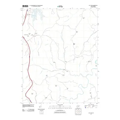
2011 Map of Flat Top
USGS Topo · Published 2011About this map
Huff Knob and Flat Top Mountain anchor the high terrain of this West Virginia landscape, where small settlements like Ghent and Flat Top sit near the Interstate 77 corridor. The map provides a detailed view of the rural upland life in 2011, noting essential community hubs such as the Ghent Post Office and the Flat Top Post Office. Family history and local heritage are well-preserved through numerous burial sites, including the Camp Creek Cemetery, Hatcher Cemetery, and Meador Cemetery.
Find a feature on this map
63 named features on this map. Tap any name to fly to it.
Don’t see what you’re looking for? This feature index may not catch every label — zoom into the map to look around manually.
Map Details
Editions of this 2011 Flat Top Map
This is the sole edition of this map. No revisions or reprints were ever made.
Other maps of this area

1887 · Pocahontas
USGS Topo · 1:125,000

1887 · Hinton
USGS Topo · 1:125,000

1890 · Dublin
USGS Topo · 1:125,000

1891 · Pocahontas
USGS Topo · 1:125,000

1891 · Dublin
USGS Topo · 1:125,000

1891 · Raleigh
USGS Topo · 1:125,000

1892 · Hinton
USGS Topo · 1:125,000

1894 · Pocahontas
USGS Topo · 1:125,000

1895 · Pocahontas
USGS Topo · 1:125,000

1897 · Raleigh
USGS Topo · 1:125,000