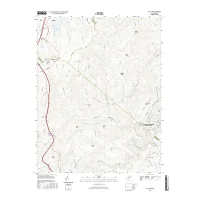
2016 Map of Flat Top
USGS Topo · Published 2016About this map
Ghent and Flat Top sit along the high ridges of the Allegheny Plateau, where the boundaries of Raleigh, Summers, and Mercer counties converge. This 2016 survey illustrates a landscape defined by sharp elevation changes, from the waters of Flat Top Lake and the Little Bluestone River to prominent high points like Huff Knob and Panther Knob. The map reveals a network of mountain settlements and family lineages, preserved through sites such as the Lilly Cem, Dunns Cem, and Hatcher Cem. To the southeast, the terrain drops toward the protected corridor of the Bluestone National Scenic River, where the Canyon Rim Trail and River Trail follow the winding waterway. The inclusion of the New River Community and Technical Coll near Ghent marks the area's modern development alongside traditional rural life in communities like Dunns and Piney Flat.
Find a feature on this map
96 named features on this map. Tap any name to fly to it.
Don’t see what you’re looking for? This feature index may not catch every label — zoom into the map to look around manually.
Map Details
Editions of this 2016 Flat Top Map
This is the sole edition of this map. No revisions or reprints were ever made.
Other maps of this area

1887 · Pocahontas
USGS Topo · 1:125,000

1887 · Hinton
USGS Topo · 1:125,000

1890 · Dublin
USGS Topo · 1:125,000

1891 · Pocahontas
USGS Topo · 1:125,000

1891 · Dublin
USGS Topo · 1:125,000

1891 · Raleigh
USGS Topo · 1:125,000

1892 · Hinton
USGS Topo · 1:125,000

1894 · Pocahontas
USGS Topo · 1:125,000

1895 · Pocahontas
USGS Topo · 1:125,000

1897 · Raleigh
USGS Topo · 1:125,000