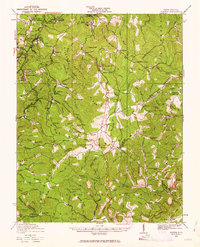
1929 Map of Flattop
USGS Topo · Published 1963About this map
The Virginian Ry carves through the narrow valleys of southern West Virginia in this 1920s survey, connecting coal-rich settlements like Winding Gulf and Besoco. This era captures the height of the mountain extraction economy, where operations like Blue Jay Mine No 7 at Cherry Glade and the specialized Lumber RR define the landscape's utility. The settlement pattern is characterized by small, family-centric school districts serving tight-knit hollows, evidenced by the high density of rural institutions such as Chestnut Ridge School, Low Gap School, and the Suck School.
Find a feature on this map
129 named features on this map. Tap any name to fly to it.
Don’t see what you’re looking for? This feature index may not catch every label — zoom into the map to look around manually.
Map Details
Editions of this 1929 Flattop Map
This is the sole edition of this map. No revisions or reprints were ever made.
Other maps of this area

1887 · Pocahontas
USGS Topo · 1:125,000

1887 · Hinton
USGS Topo · 1:125,000

1890 · Dublin
USGS Topo · 1:125,000

1891 · Pocahontas
USGS Topo · 1:125,000

1891 · Dublin
USGS Topo · 1:125,000

1891 · Raleigh
USGS Topo · 1:125,000

1892 · Hinton
USGS Topo · 1:125,000

1894 · Pocahontas
USGS Topo · 1:125,000

1895 · Pocahontas
USGS Topo · 1:125,000

1897 · Raleigh
USGS Topo · 1:125,000