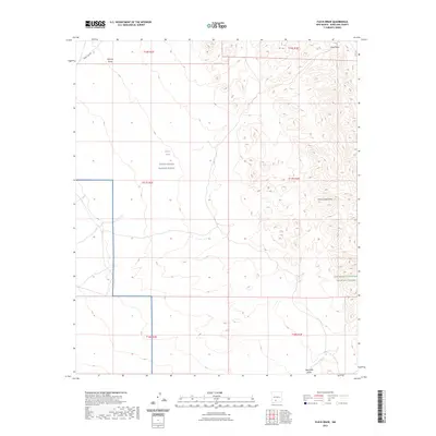
2023 Map of Fleck Draw
USGS Topo · Published 2023About this map
The White Sands Missile Range occupies a significant portion of this high-desert landscape in Doña Ana County, highlighting the region's intersection of military history and conservation. To the east, the terrain transitions into the San Andres National Wildlife Refuge, a protected area defined by its complex network of seasonal drainages. These arid watercourses, including Fleck Draw, Gilmore Draw, and Horse Camp Draw, dominate the topography, revealing the natural drainage patterns of the basin. The presence of Indian Tank and New Well Draw suggests the critical importance of managed water points in this environment. Primarily accessed by military corridors like WSMR 5 Rd 306, the area remains largely undeveloped, preserving a specific mid-2020s view of federal land management and its geographical boundaries.
Find a feature on this map
14 named features on this map. Tap any name to fly to it.
Don’t see what you’re looking for? This feature index may not catch every label — zoom into the map to look around manually.
Map Details
Editions of this 2023 Fleck Draw Map
This is the sole edition of this map. No revisions or reprints were ever made.
Other maps of this area

1916 · Tonuco
USGS Topo · 1:125,000

1932 · Tonuco
USGS Topo · 1:125,000

1948 · Chicken Well
USGS Topo · 1:62,500

1948 · Bear Peak
USGS Topo · 1:62,500

1948 · San Diego Mountain
USGS Topo · 1:62,500

1948 · Kaylor Mountain
USGS Topo · 1:62,500

1955 · Las Cruces
USGS Topo · 1:250,000

1958 · Las Cruces
USGS Topo · 1:250,000

1981 · Gilmore Draw
USGS Topo · 1:24,000
1981 · Fleck Draw
USGS Topo · 1:24,000