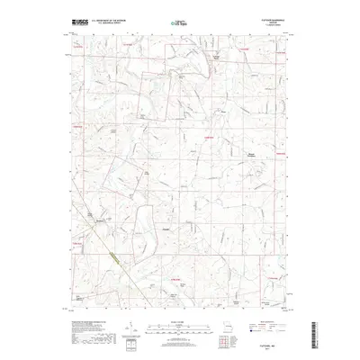
2017 Map of Fletcher
USGS Topo · Published 2017About this map
The Big River winds through the heart of this Jefferson County landscape, carving a deep valley through the northern reaches of the Saint Francois Mountains. Settlement is concentrated in small communities like Fletcher and Ware, where rural life is anchored by several local burial grounds including McCain Cem and Maness Cem. The terrain is defined by its dramatic relief, featuring prominent points like Harness Bluff and a series of named valleys such as Cedar Hollow and Grinnin Hollow. This 2017 survey reflects the modern road network, including State Hwy H, while preserving the locations of historical hamlets like Frumet. Water is a defining element of the area, with numerous small impoundments such as Lake George and Kinnippi Lake punctuating the wooded hillsides east of Mount Freedom.
Find a feature on this map
120 named features on this map. Tap any name to fly to it.
Don’t see what you’re looking for? This feature index may not catch every label — zoom into the map to look around manually.
Map Details
Editions of this 2017 Fletcher Map
This is the sole edition of this map. No revisions or reprints were ever made.
Other maps of this area

1901 · De Soto
USGS Topo · 1:125,000

1930 · De Soto NE
USGS Topo · 1:24,000

1930 · Pacific SE
USGS Topo · 1:24,000

1931 · De Soto SE
USGS Topo · 1:24,000

1937 · Fletcher
USGS Topo · 1:24,000

1937 · Tiff
USGS Topo · 1:24,000

1938 · Cedar Hill
USGS Topo · 1:24,000

1938 · Fletcher
USGS Topo · 1:24,000

1939 · Tiff
USGS Topo · 1:24,000

1940 · Cedar Hill
USGS Topo · 1:24,000