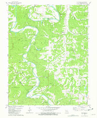
1981 Map of Fletcher
USGS Topo · Published 1982About this map
The winding Big River dominates this Jefferson County landscape, carving through hills and creating natural crossings like those found at Browns Ford Road and Engle Ford Road. By the early 1980s, the area remained largely rural, defined by small settlements like Fletcher and Ware and a network of family-named landmarks. The presence of several distinct burial grounds, including McCain Cem and Maness Cem, provides significant data for genealogists tracking local families near the Jefferson-Washington County line.
Find a feature on this map
45 named features on this map. Tap any name to fly to it.
Don’t see what you’re looking for? This feature index may not catch every label — zoom into the map to look around manually.
Map Details
Editions of this 1981 Fletcher Map
This is the sole edition of this map. No revisions or reprints were ever made.
Other maps of this area

1901 · De Soto
USGS Topo · 1:125,000

1930 · De Soto NE
USGS Topo · 1:24,000

1930 · Pacific SE
USGS Topo · 1:24,000

1931 · De Soto SE
USGS Topo · 1:24,000

1937 · Fletcher
USGS Topo · 1:24,000

1937 · Tiff
USGS Topo · 1:24,000

1938 · Cedar Hill
USGS Topo · 1:24,000

1938 · Fletcher
USGS Topo · 1:24,000

1939 · Tiff
USGS Topo · 1:24,000

1940 · Cedar Hill
USGS Topo · 1:24,000