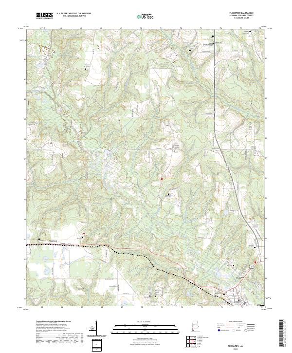
2024 Map of Flomaton
USGS Topo · Published 2024About this map
The borderlands of Escambia County, Alabama, center on the rail-influenced landscape of Flomaton. This contemporary survey details a region where deep-rooted family history is preserved through a remarkable density of burial grounds, including the Poston Family Cem and Boutwell Lambeth Cem. The settlement at Wawbeek sits to the west, while the landscape is defined by the winding paths of Sizemore Creek and Hall Creek. Local spiritual life is anchored by institutions like Halls Creek Church and the Red Oak Missionary Baptist Church, each with its own legacy etched into the map. To the south, the presence of the Flomaton Airport and Lake Weaver provides a contrast to the surrounding woodlands and rural roads. The intricate network of creek branches—such as Bills Branch and Dry Branch—illustrates the natural drainage patterns that have shaped land use and property boundaries since the early days of Alabama settlement.
Find a feature on this map
96 named features on this map. Tap any name to fly to it.
Don’t see what you’re looking for? This feature index may not catch every label — zoom into the map to look around manually.
Map Details
Editions of this 2024 Flomaton Map
This is the sole edition of this map. No revisions or reprints were ever made.
Other maps of this area

1941 · Century
USGS Topo · 1:62,500

1943 · Century
USGS Topo · 1:62,500

1943 · Jay
USGS Topo · 1:62,500

1953 · Andalusia
USGS Topo · 1:250,000

1957 · Andalusia
USGS Topo · 1:250,000

1957 · Pensacola
USGS Topo · 1:250,000

1959 · Pensacola
USGS Topo · 1:250,000

1960 · Pensacola
USGS Topo · 1:250,000

1960 · Atmore
USGS Topo · 1:24,000

1960 · Huxford
USGS Topo · 1:24,000