Old Maps of Escambia County, Alabama
Explore 210 old maps of Escambia County, spanning from 1941 to today. These high-resolution historic maps reveal how streets, neighborhoods, landmarks, and natural features evolved over time — perfect for genealogy, metal detecting, research, and local history exploration.
What you can do with these maps:
- See how Escambia County changed over time: Compare historical maps to modern-day views to trace roads, homesites, rail lines & more.
- View detailed metadata: Each map includes creators, publishers, year, scale, and archive source.
- Overlay maps with satellite & LiDAR: Visualize the past alongside modern tools to explore terrain & human change.
- Trusted historical sources: Maps sourced from the USGS, Library of Congress, and other archives.
- Access maps your way: View online, download high-res files, or order prints for personal or research use.
Start exploring old maps of Escambia County to uncover forgotten places, hidden landmarks, and the deep history beneath your feet.
Escambia County, AL maps
(210)- 1941 Map of Century, 1962 Print
 1941 Century1962 Print · USGSThe Florida-Alabama borderlands come alive in the early 1940s as a landscape of river-bottom wetlands and upland rail towns. Genealogists can trace family roots at Coon Hill Cem, Kays Chapel, and long-standing schools like Pine Barren Sch.2 unique versions available
 - 1942 Map of Perdido, 1965 Print
 1942 Perdido1965 Print · USGSCoastal Alabama and its inland timberlands are captured here in the early 1940s, showing a transition from remote logging camps to growing railroad towns. Genealogists can locate family landmarks like Steadham Cem, the Langham Lottie Sch, and settlements at Lottie and Nokomis.
 - 1942 Map of Dyas, 1965 Print
 1942 Dyas1965 Print · USGSThe borderlands of Alabama and Florida are captured here during the early 1940s, highlighting a landscape shaped by timber and the Perdido River. Genealogists can locate family landmarks like Cain Cem, Nokomis Sch, and the St Stephens and St Louis RR.2 unique versions available
 - 1943 Map of Century
 1943 Century1943 Print · USGSThe Florida-Alabama borderlands in the 1940s are defined by the winding Escambia River and a thriving rail-and-timber network. Researchers can trace rural life through family-named landmarks like Coon Hill Cem, Ward Sch, and Chumuckla Springs.2 unique versions available
 - 1943 Map of Jay
 1943 Jay1943 Print · USGSSanta Rosa County's agricultural and riverine heartland is captured here during the early years of the Second World War. Researchers can locate vanished landmarks like Catawba Fidelis Sch and Old Fidelis Cem or trace family roots in Jay and Chumuckla.4 unique versions available
 - 1944 Map of Dyas
 1944 Dyas1944 Print · USGSThe Alabama-Florida borderlands come to life in the mid-1940s, showing the rural communities and timberlands of Baldwin County. Trace old family names and landmarks like Cain Cem, New Providence Ch, and the Walnut Hill Fire Tower.2 unique versions available
 - 1944 Map of Perdido
 1944 Perdido1944 Print · USGSCoastal plain settlements and timber country in South Alabama come alive on this mid-forties survey. Trace family history at Lindsey Cem and St Johns Ch, or locate vanished rail stops along the Logging RR and St Louis - San Francisco RR.2 unique versions available
 - 1948 Map of Munson, 1958 Print
 1948 Munson1958 Print · USGSSanta Rosa County's timberlands are captured here in the late 1940s, just as modern forest management was taking root. Researchers can locate family sites and early community landmarks like Sellersville, Black Cem, and the Munson High School.2 unique versions available
 - 1949 Map of Crestview, 1960 Print
 1949 Crestview1960 Print · USGSOkaloosa County at the close of the 1940s shows a landscape of river-bottom forests and rural crossroads. Researchers can trace family sites at Pilgrims Rest Ch, locate old timber operations like Campbells Mill, and follow the Louisville & Nashville rail line through Crestview.2 unique versions available
 - 1950 Map of Munson
 1950 Munson1950 Print · USGSNorth Florida and southern Alabama meet within the dense timberlands of the Blackwater River State Forest during the mid-century. Researchers can trace the routes of the Three Notch Road and locate rural landmarks like Camp Lowry, Spring Hill Sch, and the Black Cem.2 unique versions available
 - 1951 Map of Crestview
 1951 Crestview1951 Print · USGSMid-century Okaloosa County is centered on the growth of Crestview along the Louisville and Nashville Railroad. Genealogists and historians can trace numerous rural landmarks, from Campbells Mill to the Old Spanish Trail and family-named sites like Peaden Cem.2 unique versions available
 - 1953 Map of Andalusia, 1965 Print
 1953 Andalusia1965 Print · USGSSouth Alabama in the mid-twentieth century remains a land of pine forests and river-fed settlements. You can trace the vital rail corridors of the Louisville & Nashville and locate regional centers such as Andalusia, Brewton, and Monroeville.3 unique versions available
 - 1957 Map of Andalusia
 1957 Andalusia1957 Print · USGSSouthern Alabama in the mid-1950s was a landscape defined by timbered stretches and the rhythmic flow of the Alabama River. Researchers can trace the legacy of the rail era through the Central of Georgia tracks and the storied river bluffs at Choctaw Bluff.
 - 1957 Map of Pensacola, 1967 Print
 1957 Pensacola1967 Print · USGSThe Florida Panhandle and Alabama coast are seen here at the height of the Cold War, showcasing a unique mix of military aviation and emerging beach tourism. Genealogists and local historians can trace legacy sites like Old Corry Field, the lumber town of Bagdad, and the coastal reaches of Santa Rosa Island.3 unique versions available
 - 1959 Map of Pensacola
 1959 Pensacola1959 Print · USGSThe Florida Panhandle and Alabama coast come alive in this late fifties survey of military aviation and maritime life. Genealogists can trace family roots in Bagdad, Loxley, and Milton while mapping the rails of the Louisville and Nashville.
 - 1959 Map of Brewton South, 1991 Print
 1959 Brewton South1991 Print · USGSThe Birmingham suburbs and the ridgeline of Shades Mountain are captured here during a period of rapid mid-century growth. Researchers can trace the development of Mountain Brook and Homewood, locating local landmarks like Howard College and Elmwood Cemetery.
 - 1960 Map of Pensacola
 1960 Pensacola1960 Print · USGSThe Florida Panhandle and Alabama's eastern shore are shown during a period of rapid military and coastal growth. Genealogists and historians can trace the mid-century footprints of Warrington, the Pensacola NAS (Chevalier), and the Blackwater River timber lands.
 - 1960 Map of Atmore, 1961 Print
 1960 Atmore1961 Print · USGSAtmore sits at a busy railroad junction on the Alabama-Florida line during a period of significant civic and agricultural growth. Researchers can trace the development of local neighborhoods and rural hubs like Canoe and Martinville, alongside landmarks such as Oak Hill Cemetery and the State Prison Farm.3 unique versions available
 - 1960 Map of Brewton South, 1961 Print
 1960 Brewton South1961 Print · USGSBrewton and East Brewton thrive at the meeting of the Conecuh River and Murder Creek during this mid-century period. Genealogists and historians can trace family ties at Fort Crawford Cem, visit Neal Sch, or locate old industries like the Sand and Gravel Pits.2 unique versions available
 - 1960 Map of Huxford, 1961 Print
 1960 Huxford1961 Print · USGSEscambia County's timber and rail landscape is captured here in the early sixties, showing the vital line of the St Louis - San Francisco Railroad. Genealogists can locate family landmarks like Sardis Ch, Miller Cem, and the massive Atmore State Prison Farm.4 unique versions available
 - 1960 Map of Pollard, 1961 Print
 1960 Pollard1961 Print · USGSThe Alabama-Florida borderlands come to life in the early 1960s, showing the intersection of the Conecuh River and the LOUISVILLE AND NASHVILLE railroad. Researchers can locate family landmarks like Hollywood Cem, McCall Sch, and the Catawba Springs Ch.3 unique versions available
 - 1960 Map of Brewton North, 1961 Print
 1960 Brewton North1961 Print · USGSThe area around Brewton in the early sixties was a landscape of creek-side settlements and growing educational institutions along the rail line. Researchers can trace the footprints of the Southern Normal Sch, Appleton, and rural landmarks like Zion Hill Cem.3 unique versions available
 - 1960 Map of Barnett Crossroads, 1961 Print
 1960 Barnett Crossroads1961 Print · USGSEscambia County's rural landscape is captured here in the early sixties, showing the crossroads communities and creek bottoms of south Alabama. Genealogists can trace family names at Magnolia Cem, New Bethlehem Ch, and the Maschmeyer Lookout Tower.3 unique versions available
 - 1960 Map of Wallace, 1961 Print
 1960 Wallace1961 Print · USGSNorth of the Florida line in the early 1960s, this area of Escambia County centers on the Louisville and Nashville rail corridor. Genealogists and historians can trace family-named sites like Hanberry Cem, Appleton, and Pleasant Hill Ch.3 unique versions available
 - 1960 Map of Flomaton, 1961 Print
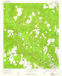 1960 Flomaton1961 Print · USGSThe Alabama-Florida borderlands near the turn of the 1960s were shaped by the Escambia River and the vital rail junctions at Flomaton. Researchers can trace rural genealogy and industry through sites like Moyeville, Hammac Cem, and the extensive Old Railroad Grade.2 unique versions available
Showing maps 1-25 of 210
Top cities of Escambia County
- Atmore historical maps
- Brewton historical maps
- East Brewton historical maps
- Flomaton historical maps
- Huxford historical maps
- Riverview historical maps
See more
Frequently asked questions
- What are the different types of historical maps available for Escambia County?
- What is the oldest map of Escambia County?
- Where can I purchase historical maps of Escambia County for my home or office?
- Where can I download high-res historical maps of Escambia County?
- Are there historical topographic maps available for Escambia County?
- Is there historical aerial imagery available for Escambia County?
- Where are historical maps of Escambia County sourced from?