
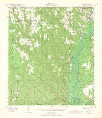
1941 Map of Century
USGS Topo · Published 1962About this map
Settlements and small-scale agriculture define this corner of the Florida panhandle and southern Alabama during the early 1940s. The Escambia River and Little Escambia River dominate the eastern landscape, creating a complex network of wetlands and oxbow lakes such as Cotton Lake, Horseshoe Lake, and Round Lake. This riparian corridor contrasts sharply with the upland settlements to the west, where timber and farming supported communities like Century, Walnut Hill, and Bratt.
Find a feature on this map
56 named features on this map. Tap any name to fly to it.
Don’t see what you’re looking for? This feature index may not catch every label — zoom into the map to look around manually.
Map Details
Editions of this 1941 Century Map
2 editions found
Other maps of this area

1920 · Milton
USGS Topo · 1:62,500

1920 · Robertsdale
USGS Topo · 1:62,500

1921 · Muscogee
USGS Topo · 1:62,500

1941 · Muscogee
USGS Topo · 1:62,500

1941 · Robertsdale
USGS Topo · 1:62,500

1941 · Milton
USGS Topo · 1:62,500

1942 · Perdido
USGS Topo · 1:62,500

1942 · Dyas
USGS Topo · 1:62,500

1943 · Robertsdale
USGS Topo · 1:62,500

1943 · Muscogee
USGS Topo · 1:62,500