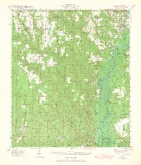
1941 Map of Century
USGS Topo · Published 1967About this map
The Escambia River flows prominently through this 1940s landscape, marking the boundary between Escambia and Santa Rosa counties. To the west, the Louisville and Nashville railroad serves as the industrial spine for timber and agricultural settlements like Century, McDavid, and Bluff Springs. Further west, the St Louis San Francisco rail line cuts through a series of rural communities including Bratt, Enon, and Bay Springs, revealing the region's historical dependence on rail transport before the dominance of modern highways. This survey details a terrain defined by numerous waterways like Canoe Creek and Pine Barren Creek, which shaped the placement of local landmarks such as Salem Ch, Land Mark Ch, and the Oak Grove Sch. Genealogists may find value in the many small family and community burial sites identified, including Carlney Cem and Bell Juniper Cem.
Find a feature on this map
70 named features on this map. Tap any name to fly to it.
Don’t see what you’re looking for? This feature index may not catch every label — zoom into the map to look around manually.
Map Details
Editions of this 1941 Century Map
2 editions found
Other maps of this area

1920 · Milton
USGS Topo · 1:62,500

1920 · Robertsdale
USGS Topo · 1:62,500

1921 · Muscogee
USGS Topo · 1:62,500

1941 · Muscogee
USGS Topo · 1:62,500

1941 · Robertsdale
USGS Topo · 1:62,500

1941 · Milton
USGS Topo · 1:62,500

1941 · Century
USGS Topo · 1:62,500

1942 · Perdido
USGS Topo · 1:62,500

1942 · Dyas
USGS Topo · 1:62,500

1943 · Robertsdale
USGS Topo · 1:62,500