
1943 Map of Muscogee
USGS Topo · Published 1943About this map
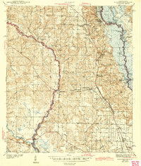
The Perdido River forms a winding natural border between Florida and Alabama in this early 1940s survey, highlighting a landscape defined by its waterways and rural communities. In the east, the Louisville and Nashville RR connects several settlements including Molino, Cantonment, and Gonzalez, while the St Louis San Francisco RR cuts across to the industrial hub of Muscogee. The interior is dotted with numerous small country institutions that served the local timber and agricultural economy, such as Little Flock Ch, Farm Hill Ch Sch, and Magee Chapel. Along the Escambia River swamps to the east, specialized river features like Webb Landing and Beaverdam Lake indicate the importance of the river for transport and local resource extraction before the development of modern highway networks.
Find a feature on this map
79 named features on this map. Tap any name to fly to it.
Don’t see what you’re looking for? This feature index may not catch every label — zoom into the map to look around manually.
Map Details
Editions of this 1943 Muscogee Map
2 editions found
Other maps of this area

1920 · Milton
USGS Topo · 1:62,500

1920 · Robertsdale
USGS Topo · 1:62,500

1921 · Bon Secour
USGS Topo · 1:62,500

1921 · Pensacola
USGS Topo · 1:62,500

1921 · Fort Barrancas
USGS Topo · 1:62,500

1921 · Muscogee
USGS Topo · 1:62,500

1941 · Fort Barrancas
USGS Topo · 1:62,500

1941 · Muscogee
USGS Topo · 1:62,500

1941 · Robertsdale
USGS Topo · 1:62,500

1941 · Pensacola
USGS Topo · 1:62,500