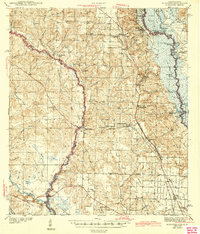
1943 Map of Muscogee
USGS Topo · Published 1943About this map
The Perdido River and Escambia River define the winding borders of this coastal plain landscape in the early 1940s. Centered around the settlement of Muscogee, the area shows a transition from the river swamps and islands like Parker Island to the growing industrial and rail hubs of Cantonment and Gonzalez. Two major rail lines, the Louisville and Nashville and the St Louis San Francisco, bisect the territory, facilitating the movement of goods through the timber and agricultural lands of Escambia County. A dense network of community infrastructure is visible, including numerous rural schools like Tate Sch and Gonzalez Sch, alongside historic burial grounds such as Santa Maria Cem and Mission Cem. The map captures the Tallahassee Base Line crossing the lower portion of the quadrangle, a critical surveying marker for Florida land divisions.
Find a feature on this map
89 named features on this map. Tap any name to fly to it.
Don’t see what you’re looking for? This feature index may not catch every label — zoom into the map to look around manually.
Map Details
Editions of this 1943 Muscogee Map
2 editions found

Other maps of this area

1920 · Milton
USGS Topo · 1:62,500

1920 · Robertsdale
USGS Topo · 1:62,500

1921 · Bon Secour
USGS Topo · 1:62,500

1921 · Pensacola
USGS Topo · 1:62,500

1921 · Fort Barrancas
USGS Topo · 1:62,500

1921 · Muscogee
USGS Topo · 1:62,500

1941 · Fort Barrancas
USGS Topo · 1:62,500

1941 · Muscogee
USGS Topo · 1:62,500

1941 · Robertsdale
USGS Topo · 1:62,500

1941 · Pensacola
USGS Topo · 1:62,500