1950s Maps of Escambia County, Alabama
Explore 7 historic maps of Escambia County from the 1950s. These maps offer a rare glimpse into what life looked like during the 1950s — showing old roads, neighborhoods, homes, and landmarks that have changed or disappeared over time.
Whether you're researching your family's past, planning a metal detecting trip, or studying how Escambia County's landscape evolved across the 1950s, these high-resolution maps are a powerful tool for exploring the history of this region.
- Focus on a specific era: All maps on this page are from the 1950s, giving you a focused view of this time period.
- See what’s changed: Compare century-old streets, trails, and buildings to today's modern landscape using overlays and satellite layers.
- Research with precision: Use these maps for genealogy, historical research, land use analysis, or educational projects.
- View, download, or print: Maps are fully viewable online in high resolution, and can be downloaded or printed for your own records.
Start exploring Escambia County's history through authentic maps from the 1950s. This is your window into the past.
Escambia County, AL maps
(7)- 1950 Map of Munson
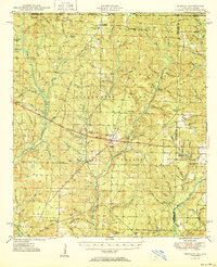 1950 Munson1950 Print · USGSNorth Florida and southern Alabama meet within the dense timberlands of the Blackwater River State Forest during the mid-century. Researchers can trace the routes of the Three Notch Road and locate rural landmarks like Camp Lowry, Spring Hill Sch, and the Black Cem.2 unique versions available
 - 1951 Map of Crestview
 1951 Crestview1951 Print · USGSMid-century Okaloosa County is centered on the growth of Crestview along the Louisville and Nashville Railroad. Genealogists and historians can trace numerous rural landmarks, from Campbells Mill to the Old Spanish Trail and family-named sites like Peaden Cem.2 unique versions available
 - 1953 Map of Andalusia, 1965 Print
 1953 Andalusia1965 Print · USGSSouth Alabama in the mid-twentieth century remains a land of pine forests and river-fed settlements. You can trace the vital rail corridors of the Louisville & Nashville and locate regional centers such as Andalusia, Brewton, and Monroeville.3 unique versions available
 - 1957 Map of Andalusia
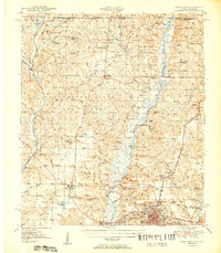
 1957 Andalusia1957 Print · USGSSouthern Alabama in the mid-1950s was a landscape defined by timbered stretches and the rhythmic flow of the Alabama River. Researchers can trace the legacy of the rail era through the Central of Georgia tracks and the storied river bluffs at Choctaw Bluff.
 - 1957 Map of Pensacola, 1967 Print
 1957 Pensacola1967 Print · USGSThe Florida Panhandle and Alabama coast are seen here at the height of the Cold War, showcasing a unique mix of military aviation and emerging beach tourism. Genealogists and local historians can trace legacy sites like Old Corry Field, the lumber town of Bagdad, and the coastal reaches of Santa Rosa Island.3 unique versions available
 - 1959 Map of Pensacola
 1959 Pensacola1959 Print · USGSThe Florida Panhandle and Alabama coast come alive in this late fifties survey of military aviation and maritime life. Genealogists can trace family roots in Bagdad, Loxley, and Milton while mapping the rails of the Louisville and Nashville.
 - 1959 Map of Brewton South, 1991 Print
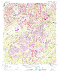 1959 Brewton South1991 Print · USGSThe Birmingham suburbs and the ridgeline of Shades Mountain are captured here during a period of rapid mid-century growth. Researchers can trace the development of Mountain Brook and Homewood, locating local landmarks like Howard College and Elmwood Cemetery.
End of results
Showing maps 1-7 of 7
Top cities of Escambia County
- Atmore historical maps
- Brewton historical maps
- East Brewton historical maps
- Flomaton historical maps
- Huxford historical maps
- Riverview historical maps
See more
Frequently asked questions
- What are the different types of historical maps available for Escambia County?
- What is the oldest map of Escambia County?
- Where can I purchase historical maps of Escambia County for my home or office?
- Where can I download high-res historical maps of Escambia County?
- Are there historical topographic maps available for Escambia County?
- Is there historical aerial imagery available for Escambia County?
- Where are historical maps of Escambia County sourced from?