1980s Maps of Escambia County, Alabama
Explore 11 historic maps of Escambia County from the 1980s. These maps offer a rare glimpse into what life looked like during the 1980s — showing old roads, neighborhoods, homes, and landmarks that have changed or disappeared over time.
Whether you're researching your family's past, planning a metal detecting trip, or studying how Escambia County's landscape evolved across the 1980s, these high-resolution maps are a powerful tool for exploring the history of this region.
- Focus on a specific era: All maps on this page are from the 1980s, giving you a focused view of this time period.
- See what’s changed: Compare century-old streets, trails, and buildings to today's modern landscape using overlays and satellite layers.
- Research with precision: Use these maps for genealogy, historical research, land use analysis, or educational projects.
- View, download, or print: Maps are fully viewable online in high resolution, and can be downloaded or printed for your own records.
Start exploring Escambia County's history through authentic maps from the 1980s. This is your window into the past.
Escambia County, AL maps
(11)- 1981 Map of Bay Minette
 1981 Bay Minette1981 Print · USGSThe Alabama-Florida borderlands come to life in the early 1980s as the river delta meets the growing coastal communities. Researchers can trace the Louisville and Nashville rail lines or locate historical points like Twenty-two Mile Bluff and the Blackwater River State Forest.2 unique versions available
 - 1982 Map of Shipps Creek
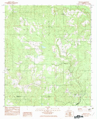
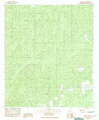 1982 Shipps Creek1982 Print · USGSEscambia County, Alabama, is shown in the early 1980s as a landscape defined by its winding waterways and rural roads. Genealogists and researchers can trace family sites near Bethel Mill Creek or locate the quiet Cem tucked away near the local creek forks.
 - 1982 Map of Roberts
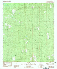
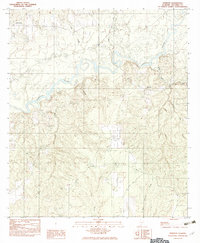 1982 Roberts1982 Print · USGSEscambia County's riverfront and timberlands are captured here in the early eighties as they appeared before modern development. Researchers can locate the settlement of Roberts, the high ground at Rock Hill, and several local Cem sites near the Conecuh River.
 - 1982 Map of Damascus
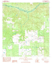
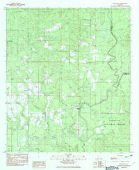 1982 Damascus1982 Print · USGSSouthern Alabama in the early eighties reveals a landscape shaped by the Conecuh River and its many tributaries. Trace the rural settlements of Damascus, Boykin, and Teddy, or locate landmarks like McGowin Bridge and Fishpond.
 - 1982 Map of Nymph
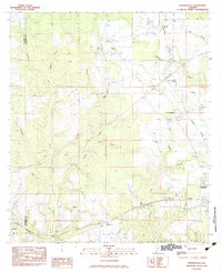
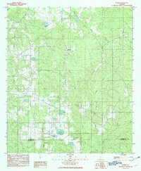 1982 Nymph1982 Print · USGSConecuh and Escambia counties are captured here in the late 1970s, showcasing a rural Alabama landscape shaped by many creeks and ponds. Genealogists and local historians can trace family-named sites like Jay Villa, McMillan Pond, and the old settlement of Old Sparta.
 - 1982 Map of Brooklyn
 1982 Brooklyn1982 Print · USGSThe borderlands of Conecuh and Escambia counties are captured here in the early eighties as a rural landscape of creek-side settlements and timbered terrain. Researchers can trace family roots through the namesake homes and sites of Brooklyn, Spring Hill, and Johnsonville.
 - 1982 Map of Parker Springs, 1983 Print
 1982 Parker Springs1983 Print · USGSEscambia County, Alabama, is shown in the early eighties as a landscape shaped by the Conecuh National Forest and its winding waterways. Researchers can trace rural settlements like Alaflora and Parker Springs alongside family landmarks like Henley Roberts.
 - 1983 Map of McCullough
 1983 McCullough1983 Print · USGSThe Alabama borderlands near the Baldwin and Escambia county line are captured here in the early 1980s. Genealogists and local historians can trace family roots at Booneville Ch & Cem, Lindsey Cem, and the settlement of Jack Springs.
 - 1983 Map of Freemanville
 1983 Freemanville1983 Print · USGSEscambia County's borderlands are detailed in this early 1980s survey, showing the rural communities of Poarch and Freemanville at a crossroads of rail and river. Genealogists can locate Mothershed Cem or trace family roots near St Annas Ch and Nokomis.
 - 1986 Map of Andalusia
 1986 Andalusia1986 Print · USGSCovington County and the Wiregrass region are shown here in the mid-1980s, centered on the growing hubs of Andalusia and Opp. Genealogists and local historians can trace legacy sites like the Old Pioneer Cem, Straughn Sch, and the rail lines of the Louisville and Nashville RR.2 unique versions available
 - 1986 Map of Atmore
 1986 Atmore1986 Print · USGSSouth Alabama’s river country and timberlands are captured here in the mid-eighties, showing the deep-water bends of the Alabama River and the expanding road networks. Genealogists and historians can trace family locations through small-town post offices and rural churches like Chrysler Ch and the settlement of Barlow Bend.2 unique versions available
End of results
Showing maps 1-11 of 11
Top cities of Escambia County
- Atmore historical maps
- Brewton historical maps
- East Brewton historical maps
- Flomaton historical maps
- Huxford historical maps
- Riverview historical maps
See more
Frequently asked questions
- What are the different types of historical maps available for Escambia County?
- What is the oldest map of Escambia County?
- Where can I purchase historical maps of Escambia County for my home or office?
- Where can I download high-res historical maps of Escambia County?
- Are there historical topographic maps available for Escambia County?
- Is there historical aerial imagery available for Escambia County?
- Where are historical maps of Escambia County sourced from?