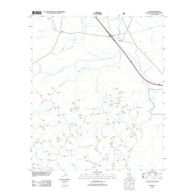
2012 Map of Flora
USGS Topo · Published 2012About this map
Cypress and Flora anchor this Natchitoches Parish landscape, where the meandering course of Kisatchie Bayou and Bayou Luce defines the local drainage pattern. The terrain transitions from the open waters of Provencal Lake in the northwest to a dense network of forest service roads and bayou systems in the south. Local history is preserved in several family and community burial grounds, including Weaver Cem, Russell Cem, and Dowen Cem. The map reveals a complex system of timber and forest access routes such as the Cypress Spur Forest Route 311 and Longleaf Vista Rd, highlighting the area's ongoing relationship with the surrounding woodlands. Notable landmarks like the Bayou Luce Overlook and Melrose Overlook provide specific points of orientation along the ridge lines and elevated terrain near Bayou Platte and Bayou Derbonne.
Find a feature on this map
44 named features on this map. Tap any name to fly to it.
Don’t see what you’re looking for? This feature index may not catch every label — zoom into the map to look around manually.
Map Details
Editions of this 2012 Flora Map
This is the sole edition of this map. No revisions or reprints were ever made.
Other maps of this area

1935 · Hagewood
USGS Topo · 1:31,680

1937 · Bermuda
USGS Topo · 1:31,680

1937 · Chopin NW
USGS Topo · 1:31,680

1937 · Bellwood
USGS Topo · 1:31,680

1937 · Montgomery
USGS Topo · 1:62,500

1937 · Cloutierville
USGS Topo · 1:31,680

1937 · Cypress
USGS Topo · 1:31,680

1942 · Kisatchie
USGS Topo · 1:62,500

1942 · Montgomery
USGS Topo · 1:62,500

1943 · Kisatchie
USGS Topo · 1:62,500