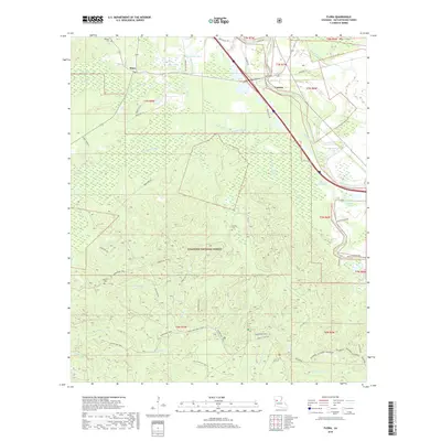
2018 Map of Flora
USGS Topo · Published 2018About this map
Cypress and Flora anchor this 2018 topographic study of Natchitoches Parish, where the complex wetlands of the Red River valley meet the upland terrain of the Kisatchie National Forest. The landscape is defined by an intricate network of waterways, including the winding Kisatchie Bayou, Old River, and Bayou Derbonne. This modern survey details the rugged character of the High Ridge and the recreational geography of the Sandstone Trail and Backbone. For genealogists and local historians, several family-named landmarks are documented, such as Weaver Cem, Russell Cem, and Dowden Cem, providing clear evidence of long-standing community ties in this rural Louisiana corridor. The map effectively illustrates the intersection of federal forest land and private holdings along historic routes like Parish Rd 712 and Good Hope Rd.
Find a feature on this map
53 named features on this map. Tap any name to fly to it.
Don’t see what you’re looking for? This feature index may not catch every label — zoom into the map to look around manually.
Map Details
Editions of this 2018 Flora Map
This is the sole edition of this map. No revisions or reprints were ever made.
Other maps of this area

1935 · Hagewood
USGS Topo · 1:31,680

1937 · Bermuda
USGS Topo · 1:31,680

1937 · Chopin NW
USGS Topo · 1:31,680

1937 · Bellwood
USGS Topo · 1:31,680

1937 · Montgomery
USGS Topo · 1:62,500

1937 · Cloutierville
USGS Topo · 1:31,680

1937 · Cypress
USGS Topo · 1:31,680

1942 · Kisatchie
USGS Topo · 1:62,500

1942 · Montgomery
USGS Topo · 1:62,500

1943 · Kisatchie
USGS Topo · 1:62,500