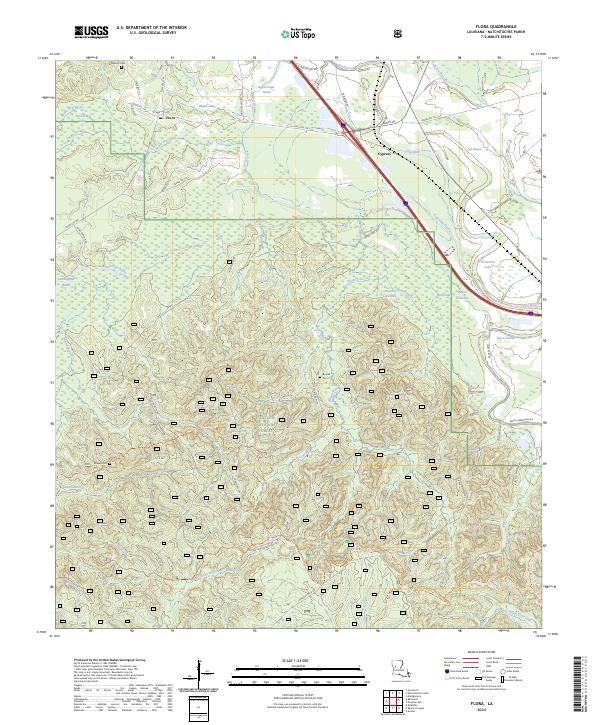
2024 Map of Flora
USGS Topo · Published 2024About this map
Flora and Cypress anchor the northern landscape of this region, where the wooded uplands of the Kisatchie National Forest give way to a complex network of bayous and wetlands. The drainage pattern here is defined by the winding course of Kisatchie Bayou, which feeds into a labyrinth of waterways including Bayou Platte, Bird Lake, and the expansive Cunningham Brake. The presence of the Kisatchie Hills Wilderness in the southeast corner indicates the preserved, primitive character of the terrain, marked by ridges like Longois Hill and the seasonal flows of Steep Hill Creek and Pole Branch. For genealogists, the map preserves the locations of several community landmarks, including Weaver Cem, Russell Cem, and Dawson Cem, providing a spatial record of family history within these rural Natchitoches Parish communities.
Find a feature on this map
62 named features on this map. Tap any name to fly to it.
Don’t see what you’re looking for? This feature index may not catch every label — zoom into the map to look around manually.
Map Details
Editions of this 2024 Flora Map
This is the sole edition of this map. No revisions or reprints were ever made.
Other maps of this area

1935 · Hagewood
USGS Topo · 1:31,680

1937 · Bermuda
USGS Topo · 1:31,680

1937 · Chopin NW
USGS Topo · 1:31,680

1937 · Bellwood
USGS Topo · 1:31,680

1937 · Montgomery
USGS Topo · 1:62,500

1937 · Cloutierville
USGS Topo · 1:31,680

1937 · Cypress
USGS Topo · 1:31,680

1942 · Kisatchie
USGS Topo · 1:62,500

1942 · Montgomery
USGS Topo · 1:62,500

1943 · Kisatchie
USGS Topo · 1:62,500