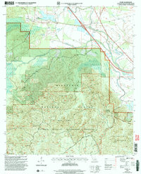
2003 Map of Flora
USGS Topo · Published 2005About this map
Flora (Weaver Sta) and its surrounding forests define this landscape in Natchitoches Parish, where the uplands of the Kisatchie Hills transition into the bottomlands of the Old River. This 2003 revision documents a region dominated by the Kisatchie National Forest, including the protected expanse of the Red Dirt National Wildlife Management Preserve. The settlement pattern follows the high ground and the corridor near Cypress, with local history anchored by sites like Weaver Cem and Antioch Ch.
Find a feature on this map
40 named features on this map. Tap any name to fly to it.
Don’t see what you’re looking for? This feature index may not catch every label — zoom into the map to look around manually.
Map Details
Editions of this 2003 Flora Map
This is the sole edition of this map. No revisions or reprints were ever made.
Other maps of this area

1935 · Hagewood
USGS Topo · 1:31,680

1937 · Bermuda
USGS Topo · 1:31,680

1937 · Chopin NW
USGS Topo · 1:31,680

1937 · Bellwood
USGS Topo · 1:31,680

1937 · Montgomery
USGS Topo · 1:62,500

1937 · Cloutierville
USGS Topo · 1:31,680

1937 · Cypress
USGS Topo · 1:31,680

1942 · Kisatchie
USGS Topo · 1:62,500

1942 · Montgomery
USGS Topo · 1:62,500

1943 · Kisatchie
USGS Topo · 1:62,500